File:Comores carte.png
Jump to navigation
Jump to search
No higher resolution available.
Comores_carte.png (326 × 350 pixels, file size: 12 KB, MIME type: image/png)
Captions
Captions
Add a one-line explanation of what this file represents
Summary[edit]
| Description |
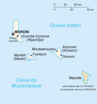
Carte des fr:Comores (francisée)
|
| Date | 24 October 2005 (original upload date) |
| Source | Transferred from fr.wikipedia to Commons. |
| Author | The original uploader was Sting at French Wikipedia. |
Licensing[edit]
This image is in the public domain because it contains materials that originally came from the United States Central Intelligence Agency's World Factbook.
|
 |
Original upload log[edit]
The original description page was here. All following user names refer to fr.wikipedia.
- 2005-10-24 22:07 Sting 330×355×7 (8978 bytes) Carte des [[Comores]] (francisée) * Source : https://www.cia.gov/library/publications/the-world-factbook/geos/cn.html - * D'après une traduction et un chargement de [[Utilisateur:Siren]] {{DomainePublic}}
Original upload log[edit]
| Date/Time | Dimensions | User | Comment |
|---|---|---|---|
| 25 January 2007, 13:22:52 | 330 × 355 (8978 bytes) | Electionworld (talk · contribs) | {{Information |Description=Carte des [[:fr:Comores]] (francisée) * Source : http://www.cia.gov/cia/publications/factbook/geos/cn.html - * Historique de la carte originale [[:fr::Image:Cn-map.JPG]] (suppr) (actu) 7 janvier 2005 à 17:21 . . [[:fr:Utilis |
File history
Click on a date/time to view the file as it appeared at that time.
| Date/Time | Thumbnail | Dimensions | User | Comment | |
|---|---|---|---|---|---|
| current | 18:02, 30 August 2022 | | 326 × 350 (12 KB) | Auguel (talk | contribs) | remove border |
| 22:07, 24 November 2014 |  | 330 × 355 (10 KB) | GifTagger (talk | contribs) | Bot: Converting file to superior PNG file. (Source: Comores_carte.gif). This GIF was problematic due to non-greyscale color table. |
You cannot overwrite this file.
File usage on Commons
The following 3 pages use this file:
File usage on other wikis
The following other wikis use this file:
- Usage on avk.wikipedia.org
- Usage on br.wikipedia.org
- Usage on cs.wikipedia.org
- Usage on fr.wikipedia.org
- Mayotte
- Comores (pays)
- Discussion:Mayotte
- Utilisateur:Nécropotame/Feuille de route
- République fédérale islamique des Comores
- Histoire de Mayotte
- Liste de villes de l'union des Comores
- Wikipédia:Oracle/semaine 17 2008
- État comorien
- Wikipédia:Le saviez-vous ?/Archives/2015
- Utilisateur:GhosterBot/Log/Archives/2015/avril
- Utilisateur:GhosterBot/BacASable/testStat/Visibilité des anecdotes (2015)
- Wikipédia:Statistiques des anecdotes de la page d'accueil/Visibilité des anecdotes (2015)/2015 04
- Wikipédia:Statistiques des anecdotes de la page d'accueil/Visibilité des anecdotes (2015)
- Wikipédia:Le saviez-vous ?/Anecdotes proposées/Archivage des discussions/Archives/2016-3
- Référendum constitutionnel comorien de 2018
- Élection présidentielle comorienne de 2024
- Président de l'union des Comores
- Usage on fr.wikinews.org
- Usage on id.wikipedia.org
- Usage on jv.wikipedia.org
- Usage on ku.wikipedia.org
- Usage on lb.wikipedia.org
- Usage on lv.wikipedia.org
- Usage on mg.wikipedia.org
- Usage on ps.wikipedia.org
- Usage on ro.wikipedia.org
- Usage on sv.wikipedia.org
- Usage on te.wikipedia.org
- Usage on vi.wikipedia.org