File:1760 Bellin Map of the Moluques - Moluccas - Moluccan Island - Geographicus - Moluques2-bellin-1760.jpg
Jump to navigation
Jump to search

Size of this preview: 430 × 600 pixels. Other resolutions: 172 × 240 pixels | 344 × 480 pixels | 550 × 768 pixels | 734 × 1,024 pixels | 1,993 × 2,780 pixels.
Original file (1,993 × 2,780 pixels, file size: 892 KB, MIME type: image/jpeg)
Captions
Captions
Add a one-line explanation of what this file represents
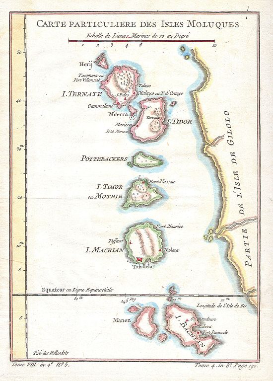
| Jacques-Nicolas Bellin: Carte Particuliere Des Isles Moluques.
( |
||||||||||||||||||||
|---|---|---|---|---|---|---|---|---|---|---|---|---|---|---|---|---|---|---|---|---|
| Artist |
|
|||||||||||||||||||
| Title |
Carte Particuliere Des Isles Moluques. |
|||||||||||||||||||
| Description |
English: This beautiful hand colored map of the Moluques (also known as the Moluccas, Moluccan Islands or simply Maluku) was produced by the French Cartographer Jacques-Nicolas Bellin in 1760. Depicts the islands of Herij, Ternate, Tidor, Pottebackers, Timor, Machian and Bachian. The Moluccan islands were once part of the Dutch East Indies. Today the Moluccas are part of Indonesia. |
|||||||||||||||||||
| Date | 1760 | |||||||||||||||||||
| Dimensions | height: 6.5 in (16.5 cm); width: 9 in (22.8 cm) | |||||||||||||||||||
| Accession number |
Geographicus link: Moluques2-bellin-1760 |
|||||||||||||||||||
| Source/Photographer |
|
|||||||||||||||||||
| Permission (Reusing this file) |
|
|||||||||||||||||||
File history
Click on a date/time to view the file as it appeared at that time.
| Date/Time | Thumbnail | Dimensions | User | Comment | |
|---|---|---|---|---|---|
| current | 20:19, 15 March 2011 | | 1,993 × 2,780 (892 KB) | BotMultichill (talk | contribs) | {{subst:User:Multichill/Geographicus |link=http://www.geographicus.com/P/AntiqueMap/Moluques2-bellin-1760 |product_name=1760 Bellin Map of the Moluques - Moluccas - Moluccan Island |map_title=Carte Particuliere Des Isles Moluques. |description=This beau |
You cannot overwrite this file.
File usage on Commons
The following page uses this file:
File usage on other wikis
The following other wikis use this file:
- Usage on de.wikipedia.org
- Usage on en.wikipedia.org
- Usage on fr.wikipedia.org
- Usage on it.wikipedia.org