File:Wales Monmouthshire locator map.svg
Jump to navigation
Jump to search

Size of this PNG preview of this SVG file: 502 × 600 pixels. Other resolutions: 201 × 240 pixels | 402 × 480 pixels | 643 × 768 pixels | 857 × 1,024 pixels | 1,714 × 2,048 pixels | 1,047 × 1,251 pixels.
Original file (SVG file, nominally 1,047 × 1,251 pixels, file size: 149 KB)
Captions
Captions
Add a one-line explanation of what this file represents
Summary[edit]
| Description |
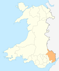
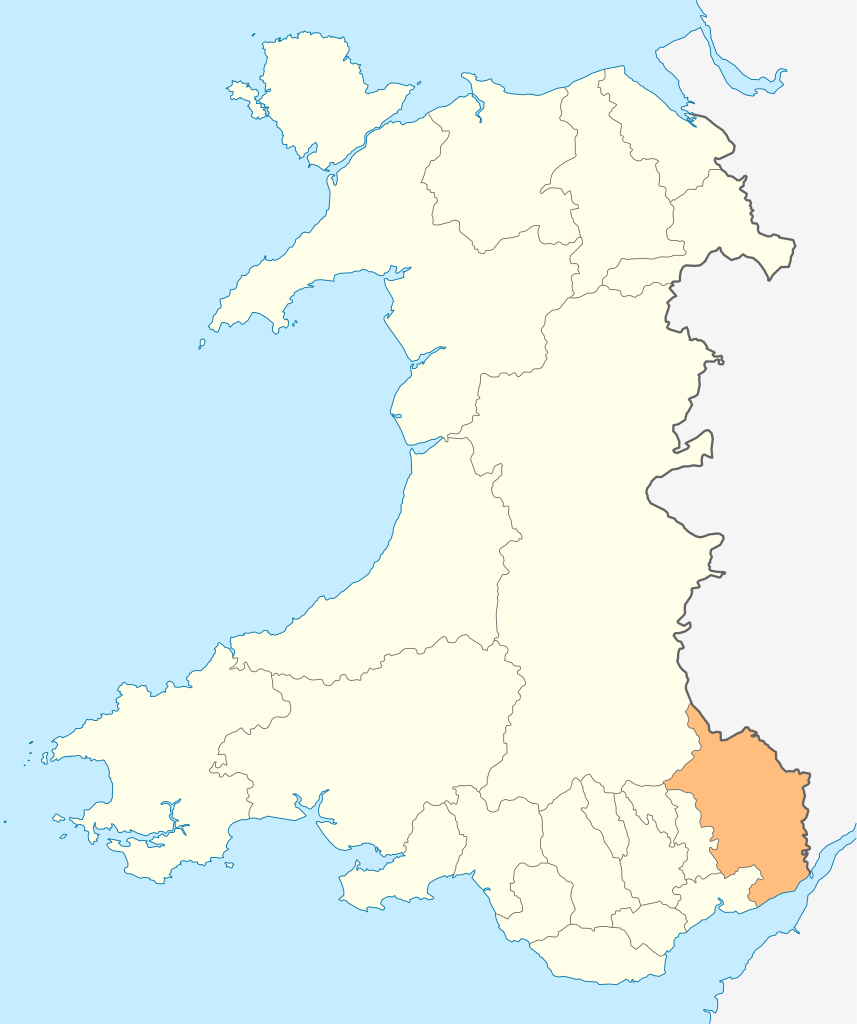
Deutsch: Lagekarte von Monmouthshire in Wales
English: Locator map of Monmouthshire in Wales |
| Date | |
| Source | Own work |
| Author | NordNordWest |
| Permission (Reusing this file) |
I, the copyright holder of this work, hereby publish it under the following license: This file is licensed under the Creative Commons Attribution-Share Alike 3.0 Unported license.
|

|
This map has been made or improved in the German Kartenwerkstatt (Map Lab). You can propose maps to improve as well.
|
File history
Click on a date/time to view the file as it appeared at that time.
| Date/Time | Thumbnail | Dimensions | User | Comment | |
|---|---|---|---|---|---|
| current | 18:54, 4 May 2010 | | 1,047 × 1,251 (149 KB) | NordNordWest (talk | contribs) | {{int:filedesc}} {{Information |Description= {{de|Lagekarte von Monmouthshire in Wales}} {{en|Locator map of Monmouthshire in Wales}} |Source={{Own}} |Date=2010-05-04 |Author={{U|NordNordWest}} |Permission={{self|cc-by-sa-3.0}} |other_versions= }} {{Kart |
You cannot overwrite this file.
File usage on Commons
The following 27 pages use this file:
- Template:Monmouthshire year
- Category:1996 in Monmouthshire
- Category:2000 in Monmouthshire
- Category:2001 in Monmouthshire
- Category:2002 in Monmouthshire
- Category:2003 in Monmouthshire
- Category:2004 in Monmouthshire
- Category:2005 in Monmouthshire
- Category:2006 in Monmouthshire
- Category:2007 in Monmouthshire
- Category:2008 in Monmouthshire
- Category:2009 in Monmouthshire
- Category:2010 in Monmouthshire
- Category:2011 in Monmouthshire
- Category:2012 in Monmouthshire
- Category:2013 in Monmouthshire
- Category:2014 in Monmouthshire
- Category:2015 in Monmouthshire
- Category:2016 in Monmouthshire
- Category:2017 in Monmouthshire
- Category:2018 in Monmouthshire
- Category:2019 in Monmouthshire
- Category:2020 in Monmouthshire
- Category:2021 in Monmouthshire
- Category:2022 in Monmouthshire
- Category:2023 in Monmouthshire
- Category:2024 in Monmouthshire
File usage on other wikis
The following other wikis use this file:
- Usage on cs.wikipedia.org
- Usage on en.wikipedia.org
- Abergavenny
- Monmouth
- Usk
- Chepstow
- Monmouthshire
- Caldicot
- Caerwent
- Llanelly
- Rogiet
- List of places in Monmouthshire
- Little Mill, Monmouthshire
- Template:Monmouthshire-geo-stub
- Llanbadoc
- Wye Valley
- River Trothy
- Llanarth, Monmouthshire
- Grosmont, Monmouthshire
- Graig Syfyrddin
- Monnow Valley Walk
- Tregare
- Blaina
- Llanddewi Rhydderch
- Ashvale, Blaenau Gwent
- Govilon
- Llantilio Pertholey
- Llanvihangel Gobion
- Llangattock Lingoed
- Llanvihangel-Ystern-Llewern
- Cross Ash
- Bryngwyn
- Cwmcarvan
- Mitchel Troy
- Newbridge-on-Usk
- Mardy, Monmouthshire
- Wolvesnewton
- Llanover
- Llancayo
- Llandenny
- Llanvetherine
- Mamhilad
- Oldcastle, Monmouthshire
- Llantrisant, Monmouthshire
- Llanwenarth
- St Arvans
- Catbrook
- Glascoed
- Llansoy
- St Maughans
- Monkswood, Monmouthshire
View more global usage of this file.