File:Litla-dimun-photo.jpg
Jump to navigation
Jump to search
No higher resolution available.
Litla-dimun-photo.jpg (640 × 426 pixels, file size: 39 KB, MIME type: image/jpeg)
Captions
Captions
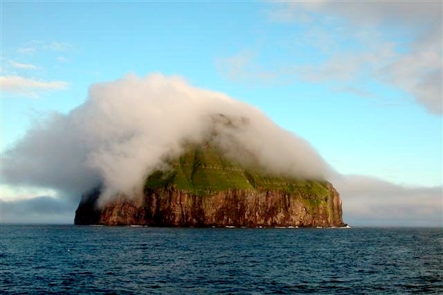
The island Lítla Dímun in the Faroes
Summary[edit]
| Description | |
| Source | Photo |
| Author | Erik Christensen, Porkeri (Website – Contact) |
|

|
Permission is granted to copy, distribute and/or modify this document under the terms of the GNU Free Documentation License, Version 1.2 or any later version published by the Free Software Foundation; with no Invariant Sections, no Front-Cover Texts, and no Back-Cover Texts. A copy of the license is included in the section entitled GNU Free Documentation License. |
| This file is licensed under the Creative Commons Attribution-Share Alike 3.0 Unported license. | ||
| ||
| This licensing tag was added to this file as part of the GFDL licensing update. |
| Object location | | View this and other nearby images on: OpenStreetMap |
|---|
File history
Click on a date/time to view the file as it appeared at that time.
| Date/Time | Thumbnail | Dimensions | User | Comment | |
|---|---|---|---|---|---|
| current | 18:11, 2 October 2010 | | 640 × 426 (39 KB) | Iketsi (talk | contribs) | Color adjustment |
| 20:23, 12 November 2004 |  | 640 × 426 (30 KB) | Arne List (talk | contribs) | GDFL |
You cannot overwrite this file.
File usage on Commons
The following 2 pages use this file:
File usage on other wikis
The following other wikis use this file:
- Usage on af.wikipedia.org
- Usage on be.wikipedia.org
- Usage on br.wikipedia.org
- Usage on ca.wikipedia.org
- Usage on cs.wikipedia.org
- Usage on da.wikipedia.org
- Usage on de.wikipedia.org
- Usage on en.wikipedia.org
- Usage on eu.wikipedia.org
- Usage on fa.wikipedia.org
- Usage on fo.wikipedia.org
- Usage on fr.wikipedia.org
- Usage on fy.wikipedia.org
- Usage on gv.wikipedia.org
- Usage on he.wikipedia.org
- Usage on ht.wikipedia.org
- Usage on hu.wikipedia.org
- Usage on id.wikipedia.org
- Usage on it.wikipedia.org
- Usage on ja.wikipedia.org
- Usage on kk.wikipedia.org
- Usage on kw.wikipedia.org
- Usage on lmo.wikipedia.org
- Usage on lt.wikipedia.org
- Usage on mi.wikipedia.org
- Usage on nl.wikipedia.org
- Usage on nn.wikipedia.org
- Usage on no.wikipedia.org
View more global usage of this file.