File:Lithuania-1867-1914-FI.svg
Jump to navigation
Jump to search

Size of this PNG preview of this SVG file: 800 × 579 pixels. Other resolutions: 320 × 232 pixels | 640 × 463 pixels | 1,024 × 742 pixels | 1,280 × 927 pixels | 2,560 × 1,854 pixels | 881 × 638 pixels.
Original file (SVG file, nominally 881 × 638 pixels, file size: 191 KB)
Captions
Captions
Add a one-line explanation of what this file represents
Summary[edit]
| Description |
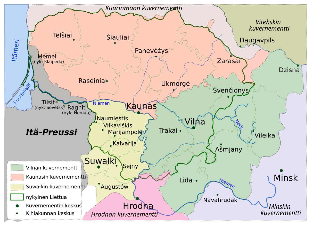
English: Map of Lithuania in Russian Empire (1867-1914). Names of each governorate (fi: kuvernementti) and their subdivision, i.e. uyezd (fi: kihlakunta, ujesti) using current Finnish. Suomi: Liettua Venäjän imperiumin aikana (vuosina 1867-1914). Kartalla on esitetty jako kuvernementteihin (ru: губерния, gubernija) ja niiden kihlakuntiin (ujesti, ru: уезд, uezd). Nimissä käytetty nykyisiä paikannimiä, Itä-Preussin puoleisille paikoille myös silloisia paikannimiä. |
| Date | |
| Source | File:Lithuania-1867-1914.svg |
| Author | Glossologist |
Licensing[edit]
| This file is made available under the Creative Commons CC0 1.0 Universal Public Domain Dedication. | |
| The person who associated a work with this deed has dedicated the work to the public domain by waiving all of their rights to the work worldwide under copyright law, including all related and neighboring rights, to the extent allowed by law. You can copy, modify, distribute and perform the work, even for commercial purposes, all without asking permission.
|
File history
Click on a date/time to view the file as it appeared at that time.
| Date/Time | Thumbnail | Dimensions | User | Comment | |
|---|---|---|---|---|---|
| current | 20:42, 2 November 2013 | | 881 × 638 (191 KB) | Paju~commonswiki (talk | contribs) | {{en|Previously missing Dzisna Uyezd was added as part of Vilna Governorate.}} {{fi|Aiemmin puuttunut Vilnan kuvernaatin Dzisnan kihlakunta lisätty kartalle.}} |
| 20:54, 24 April 2013 |  | 881 × 638 (189 KB) | Paju~commonswiki (talk | contribs) | User created page with UploadWizard |
You cannot overwrite this file.
File usage on Commons
There are no pages that use this file.
File usage on other wikis
The following other wikis use this file:
- Usage on fi.wikipedia.org