File:Four color world map.svg
Jump to navigation
Jump to search

Size of this PNG preview of this SVG file: 800 × 353 pixels. Other resolutions: 320 × 141 pixels | 640 × 283 pixels | 1,024 × 452 pixels | 1,280 × 565 pixels | 2,560 × 1,130 pixels | 940 × 415 pixels.
Original file (SVG file, nominally 940 × 415 pixels, file size: 1.58 MB)
Captions
Captions
Add a one-line explanation of what this file represents
Summary[edit]
| Description |
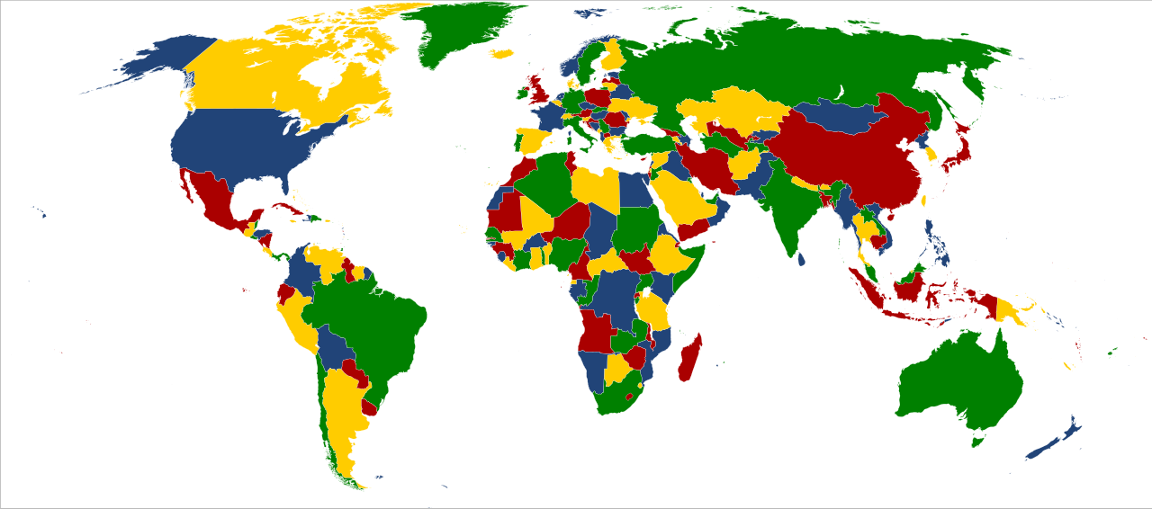
English: World map colored in green, yellow, blue and red to illustrate the four color theorem. This map considers just only land boundaries, although insular States have been colored too.
Español: Mapa del mundo coloreado de verde, amarillo, azul y rojo para ilustrar el teorema de los cuatro colores. El mapa considera únicamente los límites terrestres, si bien los Estados insulares también están coloreados. |
| Date | |
| Source | Own work, based on File:BlankMap-World6, compact.svg, uploaded by Lokal_Profil. |
| Author | XalD |
Licensing[edit]
| I, the copyright holder of this work, release this work into the public domain. This applies worldwide. In some countries this may not be legally possible; if so: I grant anyone the right to use this work for any purpose, without any conditions, unless such conditions are required by law. |
File history
Click on a date/time to view the file as it appeared at that time.
| Date/Time | Thumbnail | Dimensions | User | Comment | |
|---|---|---|---|---|---|
| current | 22:24, 12 August 2012 | | 940 × 415 (1.58 MB) | SiBr4 (talk | contribs) | Somehow Georgia disappeared... |
| 22:21, 12 August 2012 |  | 940 × 415 (1.58 MB) | SiBr4 (talk | contribs) | Adding South Sudan | |
| 20:22, 29 December 2009 |  | 940 × 415 (1.57 MB) | XalD (talk | contribs) | {{Information |Description={{en|1=World map coloured of green, yellow, blue and red for illustrate the four color theorem. This map considers just only land boundaries, although insular States have been colored too.}} {{es|1=Map |
You cannot overwrite this file.
File usage on Commons
There are no pages that use this file.
File usage on other wikis
The following other wikis use this file:
- Usage on ca.wikipedia.org
- Usage on de.wikiversity.org
- Usage on en.wikipedia.org
- Usage on es.wikipedia.org
- Usage on eu.wikipedia.org