File:Tallinn TV Tower.jpg
Jump to navigation
Jump to search

Size of this preview: 800 × 600 pixels. Other resolutions: 320 × 240 pixels | 640 × 480 pixels | 1,024 × 768 pixels | 1,280 × 960 pixels | 2,560 × 1,920 pixels | 4,000 × 3,000 pixels.
Original file (4,000 × 3,000 pixels, file size: 3.14 MB, MIME type: image/jpeg)
Captions
Captions
Add a one-line explanation of what this file represents
| Description |
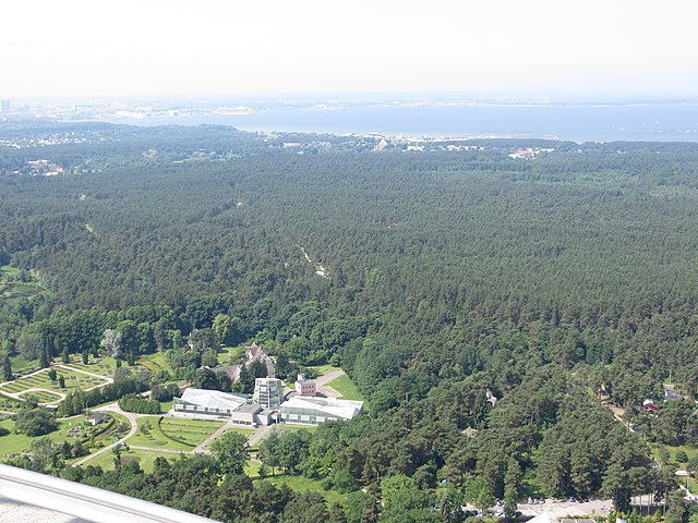
View of Tallinn harbor, in the distance, and Tallinn Botanic Garden almost at the foot of the tower. [<a href="http://beer-trotter.blogspot.no/2013/07/tallinn-start-of-baltic-journey.html" rel="nofollow">blog entry</a>] |
||
| Date | |||
| Source | Flickr: Tallinn TV Tower | ||
| Author | Bernt Rostad | ||
| Permission (Reusing this file) |
This file is licensed under the Creative Commons Attribution 2.0 Generic license.
|
| Camera location | | View this and other nearby images on: OpenStreetMap |
|---|
File history
Click on a date/time to view the file as it appeared at that time.
| Date/Time | Thumbnail | Dimensions | User | Comment | |
|---|---|---|---|---|---|
| current | 15:06, 11 August 2013 | | 4,000 × 3,000 (3.14 MB) | Flickr upload bot (talk | contribs) | Uploaded from http://flickr.com/photo/67975030@N00/9365963224 using Flickr upload bot |
You cannot overwrite this file.
File usage on Commons
There are no pages that use this file.
File usage on other wikis
The following other wikis use this file:
- Usage on en.wikivoyage.org
- Usage on es.wikipedia.org
- Usage on et.wikipedia.org
- Usage on ja.wikivoyage.org
- Usage on pl.wikivoyage.org
- Usage on ru.wikipedia.org
- Usage on uk.wikipedia.org