File:Russian Empire 1786 Map.jpg
Jump to navigation
Jump to search

Size of this preview: 800 × 388 pixels. Other resolutions: 320 × 155 pixels | 640 × 310 pixels | 1,024 × 497 pixels | 1,280 × 621 pixels | 2,560 × 1,242 pixels | 21,504 × 10,432 pixels.
Original file (21,504 × 10,432 pixels, file size: 35.25 MB, MIME type: image/jpeg)
Captions
Captions
Add a one-line explanation of what this file represents
| Warning | The original file is very high-resolution. It might not load properly or could cause your browser to freeze when opened at full size. |
|---|
Summary[edit]
| Description |
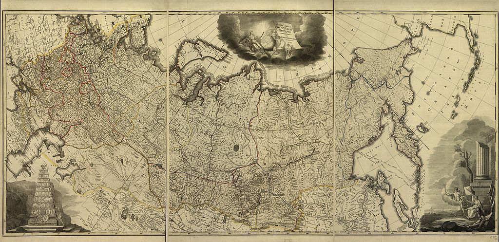
Русский: Карта Российской империи 1786 года. Показаны границы наместничеств.
English: Map of the Russian Empire in 1786 year. Borders of Namestnichesvo's shown |
| Date | |
| Source |
Русский: Библиотека Конгресса
English: Library of Congress |
| Author | Unknown author |
Licensing[edit]
|
This work is in the public domain in its country of origin and other countries and areas where the copyright term is the author's life plus 100 years or fewer. | |
| This file has been identified as being free of known restrictions under copyright law, including all related and neighboring rights. | |
File history
Click on a date/time to view the file as it appeared at that time.
| Date/Time | Thumbnail | Dimensions | User | Comment | |
|---|---|---|---|---|---|
| current | 23:17, 7 November 2009 | | 21,504 × 10,432 (35.25 MB) | Transcend (rus) (talk | contribs) | == {{int:filedesc}} == {{Information |Description= {{ru|Карта Российской империи 1786 года. Показаны границы наместничеств.}} {{en|1= Map of the Russian Empire in 1786 year. Borders of Namestnichesvo's |
You cannot overwrite this file.
File usage on Commons
There are no pages that use this file.
File usage on other wikis
The following other wikis use this file:
- Usage on et.wikipedia.org