File:Susquehanna River watershed.png
Jump to navigation
Jump to search
Size of this preview: 597 × 600 pixels. Other resolutions: 239 × 240 pixels | 478 × 480 pixels | 1,000 × 1,005 pixels.
Original file (1,000 × 1,005 pixels, file size: 373 KB, MIME type: image/png)
Captions
Captions
Add a one-line explanation of what this file represents
Summary[edit]
| Description |
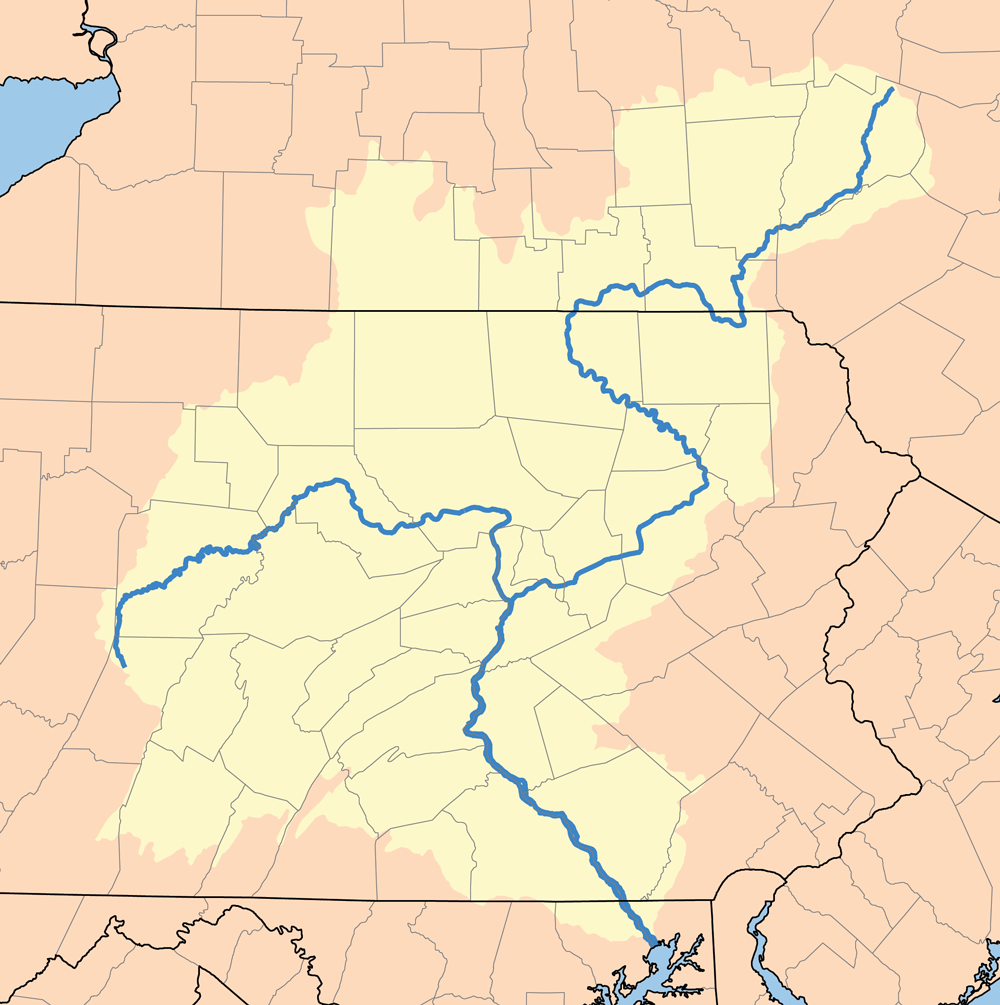
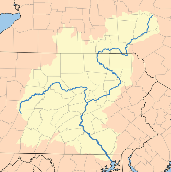
English: This is a map of the Susquehanna River Watershed. |
| Source | Own work: based on USGS data. |
| Author | I, Karl Musser, created it |
I, the copyright holder of this work, hereby publish it under the following license:
This file is licensed under the Creative Commons Attribution-Share Alike 2.5 Generic license.
- You are free:
- to share – to copy, distribute and transmit the work
- to remix – to adapt the work
- Under the following conditions:
- attribution – You must give appropriate credit, provide a link to the license, and indicate if changes were made. You may do so in any reasonable manner, but not in any way that suggests the licensor endorses you or your use.
- share alike – If you remix, transform, or build upon the material, you must distribute your contributions under the same or compatible license as the original.
File history
Click on a date/time to view the file as it appeared at that time.
| Date/Time | Thumbnail | Dimensions | User | Comment | |
|---|---|---|---|---|---|
| current | 16:12, 6 July 2012 | | 1,000 × 1,005 (373 KB) | Kmusser (talk | contribs) | increased resolution |
| 17:03, 14 May 2007 |  | 500 × 500 (144 KB) | Kmusser (talk | contribs) | increased resolution | |
| 19:56, 26 April 2006 |  | 200 × 200 (14 KB) | Kmusser (talk | contribs) | This is a map of the Susquehanna River Watershed. I, Karl Musser, created it based on USGS data. {{GFDL}} Category:Maps of rivers |
You cannot overwrite this file.
File usage on Commons
The following page uses this file:
- File:Susq.png (file redirect)
File usage on other wikis
The following other wikis use this file:
- Usage on azb.wikipedia.org
- Usage on be.wikipedia.org
- Usage on bg.wikipedia.org
- Usage on ca.wikipedia.org
- Usage on cs.wikipedia.org
- Usage on da.wikipedia.org
- Usage on de.wikipedia.org
- Usage on de.wikinews.org
- Usage on en.wikipedia.org
- Usage on es.wikipedia.org
- Usage on et.wikipedia.org
- Usage on fi.wikipedia.org
- Usage on frr.wikipedia.org
- Usage on fr.wikipedia.org
- Usage on fy.wikipedia.org
- Usage on gl.wikipedia.org
- Usage on hu.wikipedia.org
- Usage on id.wikipedia.org
- Usage on it.wikipedia.org
- Usage on ja.wikipedia.org
- Usage on ml.wikipedia.org
- Usage on new.wikipedia.org
- Usage on nl.wikipedia.org
- Usage on no.wikipedia.org
- Usage on pdc.wikipedia.org
- Usage on pl.wikipedia.org
- Usage on pms.wikipedia.org
- Usage on pt.wikipedia.org
- Usage on ru.wikipedia.org
- Usage on sh.wikipedia.org
- Usage on sr.wikipedia.org
- Usage on sv.wikipedia.org
- Usage on sw.wikipedia.org
- Usage on th.wikipedia.org
- Usage on tr.wikipedia.org
View more global usage of this file.