File:Pacific Area - The Imperial Powers 1939 - Map-es.svg
Jump to navigation
Jump to search

Size of this PNG preview of this SVG file: 765 × 599 pixels. Other resolutions: 306 × 240 pixels | 613 × 480 pixels | 980 × 768 pixels | 1,280 × 1,003 pixels | 2,560 × 2,006 pixels | 1,039 × 814 pixels.
Original file (SVG file, nominally 1,039 × 814 pixels, file size: 2.89 MB)
Captions
Captions
Add a one-line explanation of what this file represents
Summary[edit]
| Description |
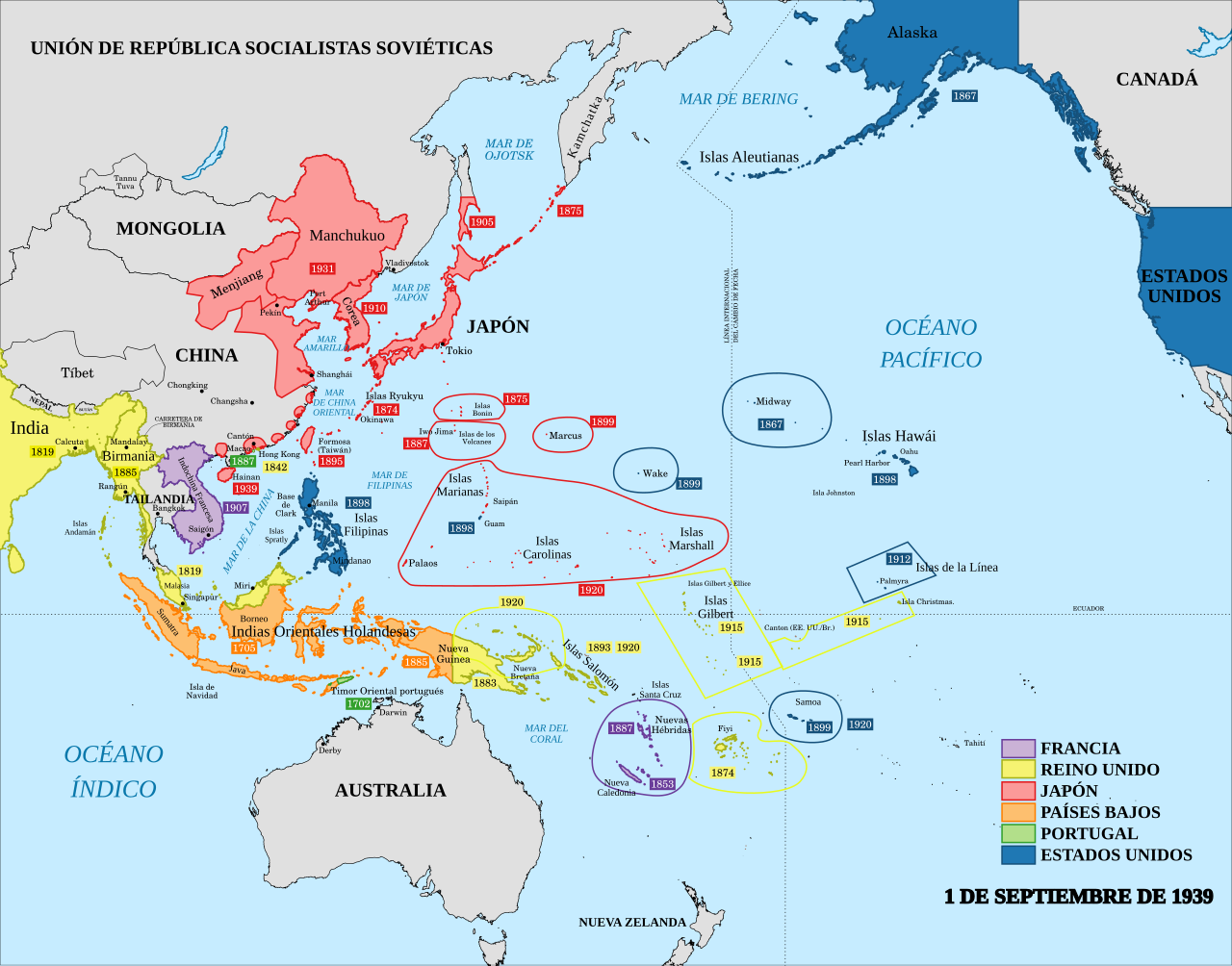
English: A map of the Imperial Powers of the Pacific, 1939-09-01. Dates shown indicate the approximate year that the various powers gain control of their possessions. Japanese control of territory in China was tenuous. Español: Las colonias del Pacífico el 1 de septiembre de 1939. |
| Date | |
| Source |
This file was derived from: Pacific Area - The Imperial Powers 1939 - Map.svg : Emok |
| Author |
|
| Other versions |
[]
|


Licensing[edit]
I, the copyright holder of this work, hereby publish it under the following license:
This file is licensed under the Creative Commons Attribution-Share Alike 4.0 International license.
- You are free:
- to share – to copy, distribute and transmit the work
- to remix – to adapt the work
- Under the following conditions:
- attribution – You must give appropriate credit, provide a link to the license, and indicate if changes were made. You may do so in any reasonable manner, but not in any way that suggests the licensor endorses you or your use.
- share alike – If you remix, transform, or build upon the material, you must distribute your contributions under the same or compatible license as the original.
File history
Click on a date/time to view the file as it appeared at that time.
| Date/Time | Thumbnail | Dimensions | User | Comment | |
|---|---|---|---|---|---|
| current | 16:06, 26 March 2020 | | 1,039 × 814 (2.89 MB) | Rowanwindwhistler (talk | contribs) | Several changes and corrections. Fake text added. |
| 20:39, 18 July 2014 |  | 1,039 × 814 (4.44 MB) | Rowanwindwhistler (talk | contribs) | User created page with UploadWizard |
You cannot overwrite this file.
File usage on Commons
The following 11 pages use this file:
- User:Magog the Ogre/Maps of conflicts/2014 July
- User:Magog the Ogre/Maps of conflicts/2020 March
- User:Magog the Ogre/Multilingual legend/2020 March 21-31
- File:Kolonialmächte im Pazifikraum, 1939.svg
- File:Pacific Area - Imperial Powers 1939 - Map.svg
- File:Pacific Area - The Imperial Powers 1939 - Map-es.svg
- File:Pacific Area - The Imperial Powers 1939 - Map-hu.svg
- File:Pacific Area - The Imperial Powers 1939 - Map-it.svg
- File:Pacific Area - The Imperial Powers 1939 - Map.svg
- File:Pacific Area - The Imperial Powers 1939 - Map mk.svg
- Template:Other versions/Pacific Area - The Imperial Powers 1939
File usage on other wikis
The following other wikis use this file:
- Usage on ast.wikipedia.org
- Usage on ca.wikipedia.org
- Usage on es.wikipedia.org
Metadata
Categories:
- Spanish-language SVG maps showing history
- Maps of the history of Oceania
- Maps showing the history of colonies
- Maps of World War II in the Pacific
- Maps of the Empire of Japan
- Maps of former colonies of the United Kingdom in Oceania
- Maps of former colonies of the United Kingdom in Asia
- Maps of former colonies of Portugal in Asia
- SVG maps of Portugal