File:Dresden Map 1895.jpg
Jump to navigation
Jump to search

Size of this preview: 469 × 600 pixels. Other resolutions: 188 × 240 pixels | 375 × 480 pixels | 600 × 768 pixels | 800 × 1,024 pixels | 1,601 × 2,048 pixels | 2,938 × 3,758 pixels.
Original file (2,938 × 3,758 pixels, file size: 2.77 MB, MIME type: image/jpeg)
Captions
Captions
Add a one-line explanation of what this file represents
| Description |
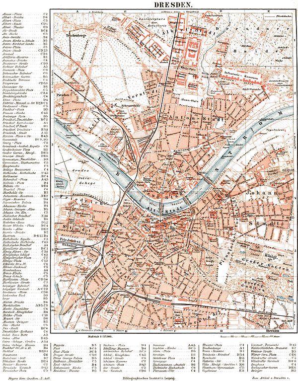
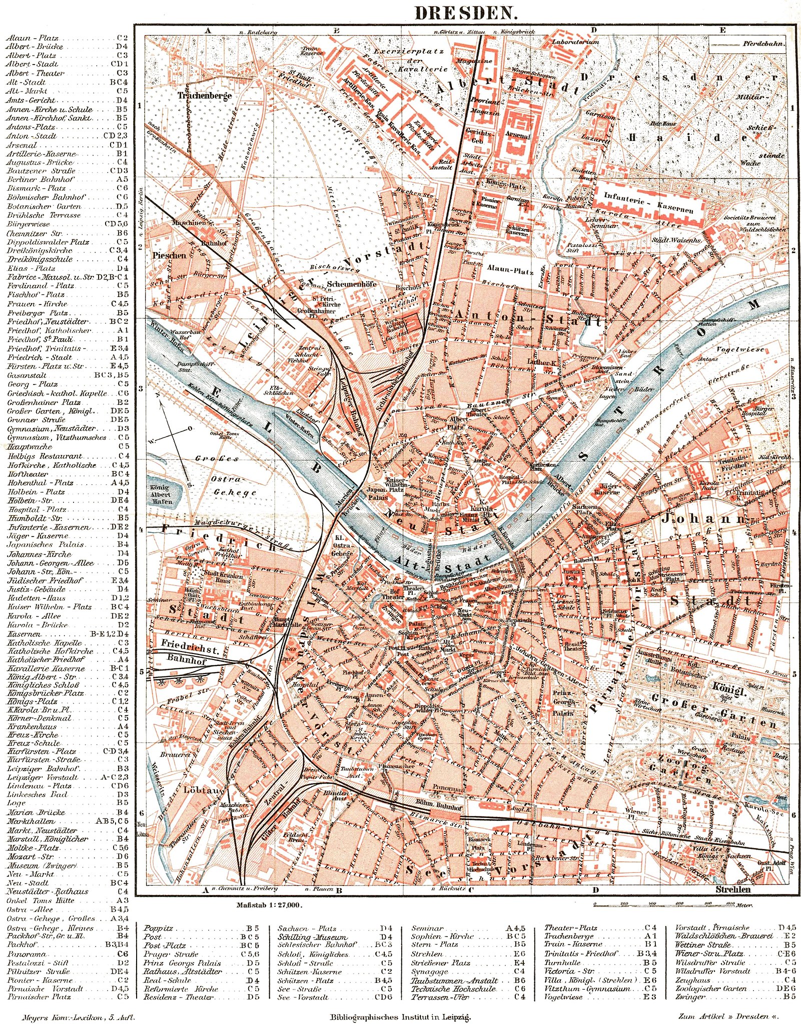
English: Map of Dresden, about 1895. |
| Date |
Deutsch: um 1895 |
| Source | Meyers Konversationslexikon (5. Aufl., 1893-97) |
| Author | Unknown author |
| Other versions |

| This image comes from the 5th edition of Meyers Konversationslexikon (1893-97). The copyrights have expired and this image is in the public domain. | 
|
This work was published before January 1, 1899 and it is anonymous or pseudonymous due to unknown authorship. It is in the public domain in the United States as well as countries and areas where the copyright terms of anonymous or pseudonymous works are 125 years or fewer since publication.
|
| Open this image as an overlay in Google Earth (Google Maps, Bing) | (Help|Source) |
File history
Click on a date/time to view the file as it appeared at that time.
| Date/Time | Thumbnail | Dimensions | User | Comment | |
|---|---|---|---|---|---|
| current | 19:17, 5 September 2005 | | 2,938 × 3,758 (2.77 MB) | Alexander Fischer (talk | contribs) | commercial inscription (www.hicleones.com) removed |
| 18:51, 5 September 2005 |  | 2,938 × 3,758 (2.77 MB) | Alexander Fischer (talk | contribs) | Map of Dresden, about 1895 {{PD-Meyers-5th-edition}} |
You cannot overwrite this file.
File usage on Commons
The following 9 pages use this file:
- Dresden
- Sachsen
- User:Red Rooster/gallery/31. August 2006
- File:Brücken westlich Hauptbahnhof Dresden 1895.jpg
- File:Dresden Map 1895-Variante 1.jpg
- File:Dresden Map 1895- Variante 222.jpg
- File:Dresden Map 1895 - Variante 1.jpg
- File:Neumarkt Karte 1895-Variante 5.jpg
- File:Neumarkt Karte 1895 png Variante Wiener Straße.jpg
File usage on other wikis
The following other wikis use this file:
- Usage on de.wikipedia.org
- Usage on de.wikiversity.org
- Usage on es.wikipedia.org
- Usage on fr.wikipedia.org