sasanian Empire Cca. 620 A.d.png
Original file (960 × 679 pixels, file size: 61 KB, MIME type: image/png)
Size of this preview: 800 × 566 pixels. Other resolutions: 320 × 226 pixels | 640 × 453 pixels | 960 × 679 pixels.
620 A.D.png">Original file (960 × 679 pixels, file size: 61 KB, MIME type: image/png)
Summary
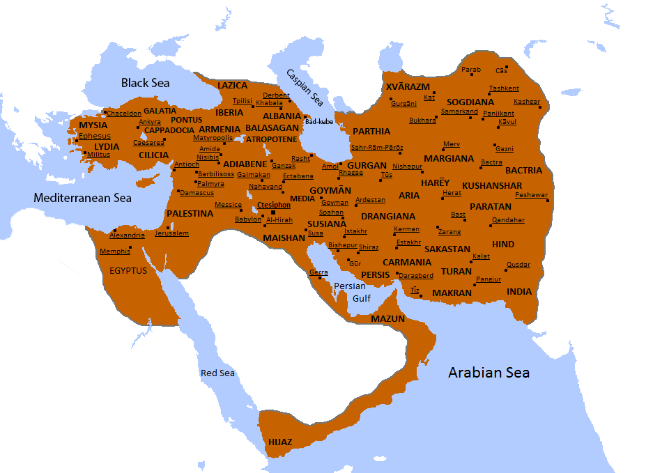
| Description | This map depicts more accurate borders of the Sasanian Empire in the year 620 A.D. |
|---|---|
| Source | I drew the borders, colored the map and labeled the cities. |
| Date | 2013-7-22 |
| Author | |
| Permission (Reusing this file) | See below.
|
- Other information
This is an improved version of the previous maps that I have uploaded prior.
Licensing
I, the copyright holder of this work, hereby publish it under the following licenses:
 | Permission is granted to copy, distribute and/or modify this document under the terms of the GNU Free Documentation License, Version 1.2 or any later version published by the Free Software Foundation; with no Invariant Sections, no Front-Cover Texts, and no Back-Cover Texts. |
| This work is licensed under the Creative Commons Attribution-ShareAlike 3.0 License. |
You may select the license of your choice.
File history
Click on a date/time to view the file as it appeared at that time.
| Date/Time | Thumbnail | Dimensions | User | Comment | |
|---|---|---|---|---|---|
| current | 05:01, 23 July 2013 | | 960 × 679 (61 KB) | (talk | ) | Uploading a self-made file using File Upload Wizard |
You cannot overwrite this file.
File usage
The following pages on the English Wikipedia use this file (pages on other projects are not listed):