File:Samarqand districts.png
Jump to navigation
Jump to search
Size of this preview: 695 × 599 pixels. Other resolutions: 278 × 240 pixels | 557 × 480 pixels | 891 × 768 pixels | 1,188 × 1,024 pixels | 1,893 × 1,632 pixels.
Original file (1,893 × 1,632 pixels, file size: 121 KB, MIME type: image/png)
Captions
Captions
Add a one-line explanation of what this file represents
Summary[edit]
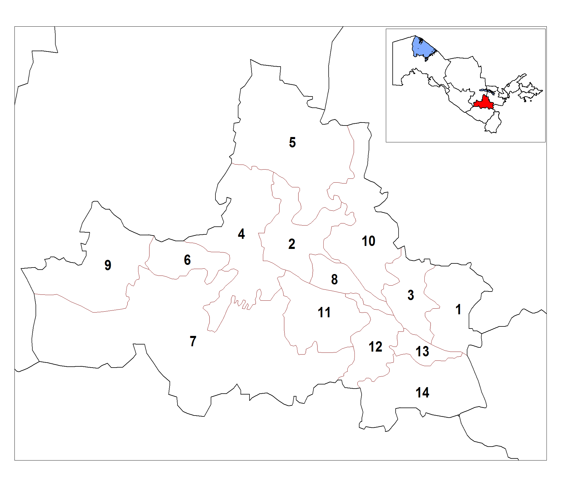
| Description | Map of the districts (tuman) of the province (viloyat) of Samarqand in Uzbekistan. |
| Date | 20 October 2008 (original upload date) |
| Source | No machine-readable source provided. Own work assumed (based on copyright claims). |
| Author | No machine-readable author provided. Rarelibra assumed (based on copyright claims). |
Licensing[edit]
| I, the copyright holder of this work, release this work into the public domain. This applies worldwide. In some countries this may not be legally possible; if so: I grant anyone the right to use this work for any purpose, without any conditions, unless such conditions are required by law. |
File history
Click on a date/time to view the file as it appeared at that time.
| Date/Time | Thumbnail | Dimensions | User | Comment | |
|---|---|---|---|---|---|
| current | 11:14, 19 January 2014 | | 1,893 × 1,632 (121 KB) | V4711 (talk | contribs) | wrong proportions fixed |
| 17:19, 20 October 2008 |  | 2,112 × 1,632 (50 KB) | Rarelibra (talk | contribs) | bigger numbers Category:Maps of Uzbekistan Category:Districts of Uzbekistan | |
| 16:00, 20 October 2008 |  | 2,112 × 1,632 (48 KB) | Rarelibra (talk | contribs) | Map of the districts (tuman) of the province (viloyat) of Samarqand in Uzbekistan. Category:Maps of Uzbekistan Category:Districts of Uzbekistan |
You cannot overwrite this file.
File usage on Commons
There are no pages that use this file.
File usage on other wikis
The following other wikis use this file:
- Usage on ar.wikipedia.org
- Usage on be-tarask.wikipedia.org
- Usage on bg.wikipedia.org
- Usage on bn.wikipedia.org
- Usage on de.wikipedia.org
- Usage on en.wikipedia.org
- Usage on es.wikipedia.org
- Usage on fa.wikipedia.org
- Usage on fr.wikipedia.org
- Usage on id.wikipedia.org
- Usage on incubator.wikimedia.org
- Usage on it.wikipedia.org
- Regione di Samarcanda
- Distretti dell'Uzbekistan
- Distretto di Bulungur
- Distretto di Ishtikhon
- Distretto di Jomboy
- Distretto di Kattakurgan
- Distretto di Koshrabot
- Distretto di Pakhtachi
- Distretto di Pasdargom
- Distretto di Narpay
- Distretto di Nurobod (Uzbekistan)
- Distretto di Oqdarya
- Distretto di Payariq
- Distretto di Samarcanda
- Distretto di Toyloq
- Distretto di Urgut
- Usage on ja.wikipedia.org
- Usage on kk.wikipedia.org
- Usage on ky.wikipedia.org
- Usage on lt.wikipedia.org
- Usage on ms.wikipedia.org
- Usage on pa.wikipedia.org
- Usage on pnb.wikipedia.org
View more global usage of this file.