File:Reliefkarte Ukraine 2022.png
Jump to navigation
Jump to search

Size of this preview: 800 × 544 pixels. Other resolutions: 320 × 217 pixels | 640 × 435 pixels | 1,024 × 696 pixels | 1,280 × 870 pixels | 2,876 × 1,954 pixels.
Original file (2,876 × 1,954 pixels, file size: 11.12 MB, MIME type: image/png)
Captions
Captions
Add a one-line explanation of what this file represents
Summary[edit]

|
This map image could be re-created using vector graphics as an SVG file. This has several advantages; see Commons:Media for cleanup for more information. If an SVG form of this image is available, please upload it and afterwards replace this template with
{{vector version available|new image name}}.
It is recommended to name the SVG file “Reliefkarte Ukraine 2022.svg”—then the template Vector version available (or Vva) does not need the new image name parameter. |
| Description |
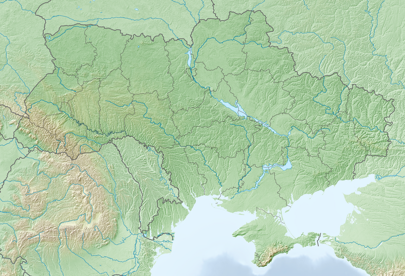
Deutsch: Reliefkarte Ukraine
Topographischer Hintergrund: NASA Shuttle Radar Topography Mission (public domain). SRTM3 v.2. |
||||||||
| Date | |||||||||
| Source | Own work | ||||||||
| Author | Tschubby | ||||||||
| Permission (Reusing this file) |
I, the copyright holder of this work, hereby publish it under the following licenses:
This file is licensed under the Creative Commons Attribution-Share Alike 2.5 Generic, 2.0 Generic and 1.0 Generic license.
You may select the license of your choice. |

File history
Click on a date/time to view the file as it appeared at that time.
| Date/Time | Thumbnail | Dimensions | User | Comment | |
|---|---|---|---|---|---|
| current | 13:30, 25 February 2024 | | 2,876 × 1,954 (11.12 MB) | Bibidimah21 (talk | contribs) | Reverted to version as of 21:22, 28 February 2022 (UTC) |
| 09:59, 11 July 2022 |  | 958 × 651 (1.2 MB) | Tschubby (talk | contribs) | {{Information |Description= |Source= |Date= |Author= |Permission= |other_versions= }} | |
| 20:32, 7 March 2022 |  | 958 × 650 (1.19 MB) | Tschubby (talk | contribs) | {{Information |Description= |Source= |Date= |Author= |Permission= |other_versions= }} | |
| 07:27, 7 March 2022 |  | 958 × 650 (1.19 MB) | Tschubby (talk | contribs) | {{Information |Description= |Source= |Date= |Author= |Permission= |other_versions= }} | |
| 20:42, 4 March 2022 |  | 958 × 651 (1.19 MB) | Tschubby (talk | contribs) | {{Information |Description= |Source= |Date= |Author= |Permission= |other_versions= }} | |
| 21:22, 28 February 2022 |  | 2,876 × 1,954 (11.12 MB) | Tschubby (talk | contribs) | {{Information |Description= |Source= |Date= |Author= |Permission= |other_versions= }} | |
| 19:54, 27 February 2022 |  | 2,876 × 1,954 (9.74 MB) | Tschubby (talk | contribs) | == {{int:filedesc}} == {{Information |Description= {{de| Reliefkarte Ukraine ohne umstrittene Gebiete}} Topographischer Hintergrund: [http://www2.jpl.nasa.gov/srtm NASA Shuttle Radar Topography Mission] (public domain). SRTM3 v.2. |Source={{own}} |Date= 2022-02-27 |Author= Tschubby |Permission= {{self|GFDL|Cc-by-sa-3.0-migrated|Cc-by-sa-2.5,2.0,1.0}} |other_versions= }} Category:Physical maps of Ukraine |
You cannot overwrite this file.
File usage on Commons
The following page uses this file:
File usage on other wikis
The following other wikis use this file:
- Usage on bcl.wikipedia.org
- Usage on bg.wikipedia.org
- Чернобил
- Киев
- Днестър
- Заводск
- Припят
- Припят (град)
- Иванков
- Бердянск
- Харков
- Лвов
- Севастопол
- Симферопол
- Ялта
- Хоруживка
- Кривой рог
- Полтава
- Кременец (Украйна)
- Яхотин
- Болград
- Мала Перешчепина
- Гостомел
- Ливадия (Крим)
- Бучач
- Донецк
- Бердичив
- Черноморск
- Чернивци
- Луганск
- Днипро
- Измаил
- Мариупол
- Херсон
- Феодосия
- Солотвино
- Горловка
- Керч
- Житомир
- Бановка (Одеска област)
- Запорожие
- Очаков
- Перекоп
- Болбока
- Виница (Украйна)
- Николаев
- Белгород Днестровски
- Судак
- Алупка
- Тернопил
View more global usage of this file.