File:Mapping van tomtom with five lidars.jpg
Jump to navigation
Jump to search

Size of this preview: 800 × 533 pixels. Other resolutions: 320 × 213 pixels | 640 × 427 pixels | 1,024 × 683 pixels | 1,280 × 853 pixels | 2,592 × 1,728 pixels.
Original file (2,592 × 1,728 pixels, file size: 1.02 MB, MIME type: image/jpeg)
Captions
Captions
Add a one-line explanation of what this file represents
Summary[edit]
| Description |
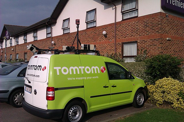
English: This TomTom branded mapping van is fitted with five LIDARs on a roof-mounted rack as well as other sensors. |
||
| Date | |||
| Source | Photographed by Mike1024 | ||
| Author | Mike1024 | ||
| Permission (Reusing this file) |
|
| Camera location | | View this and other nearby images on: OpenStreetMap |
|---|
File history
Click on a date/time to view the file as it appeared at that time.
| Date/Time | Thumbnail | Dimensions | User | Comment | |
|---|---|---|---|---|---|
| current | 17:15, 6 June 2012 | | 2,592 × 1,728 (1.02 MB) | Mike1024 (talk | contribs) | {{Coord|51.768192|-0.233826|display=title}} {{Information |Description={{en|This TomTom branded mapping van is fitted with five LIDARs on a roof-mounted rack as well as other sensors.}} |Source=Photographed by Mike1024 |Date=2012-... |
You cannot overwrite this file.
File usage on Commons
There are no pages that use this file.
File usage on other wikis
The following other wikis use this file: