File:High Rise Living at Deansgate Square, geograph 7187627 by David Dixon.jpg
Jump to navigation
Jump to search
Size of this preview: 450 × 600 pixels. Other resolutions: 180 × 240 pixels | 360 × 480 pixels | 768 × 1,024 pixels.
Original file (768 × 1,024 pixels, file size: 1.08 MB, MIME type: image/jpeg)
Captions
Captions
Add a one-line explanation of what this file represents
Summary[edit]
| Description |
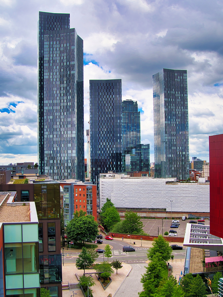
English: The four new tower blocks built around Deansgate Square dominate the skyline in the recently-regenerated area near Deansgate Station. Development of the area began in May 2016, with the four towers being completed in May 2018 (West Tower), November 2018 (South Tower) and August 2019 (North and East Towers). When completed, in 2018, the 64-storey South Tower surpassed the Beetham Tower as the tallest building in Manchester; it is currently the tenth highest in the UK (the tallest outside London). |
||
| Date | |||
| Source | geograph.org.uk | ||
| Author | David Dixon | ||
| Permission (Reusing this file) |
This file is licensed under the Creative Commons Attribution-Share Alike 2.0 Generic license. Attribution: David Dixon
|
||
| Attribution (required by the license) | David Dixon / High Rise Living at Deansgate Square / | ||

| Camera location | | View this and other nearby images on: OpenStreetMap |
|---|
_region:GB-EAW_heading:270.00&language=en)
| Object location | | View this and other nearby images on: OpenStreetMap |
|---|
_region:GB-EAW_heading:270.00&language=en)
File history
Click on a date/time to view the file as it appeared at that time.
| Date/Time | Thumbnail | Dimensions | User | Comment | |
|---|---|---|---|---|---|
| current | 07:39, 8 April 2023 | | 768 × 1,024 (1.08 MB) | G-13114 (talk | contribs) | {{Information |description={{en|1=The four new tower blocks built around Deansgate Square dominate the skyline in the recently-regenerated area near Deansgate Station. Development of the area began in May 2016, with the four towers being completed in May 2018 (West Tower), November 2018 (South Tower) and August 2019 (North and East Towers). When completed, in 2018, the 64-storey South Tower surpassed the Beetham Tower as the tallest building in Manchester; it is currently the tenth highest i... |
You cannot overwrite this file.
File usage on Commons
The following page uses this file:
File usage on other wikis
The following other wikis use this file:
- Usage on en.wikipedia.org
- Usage on sl.wikipedia.org