File:Atlas-Mountains-Labeled-2.jpg
Jump to navigation
Jump to search

Size of this preview: 800 × 401 pixels. Other resolutions: 320 × 161 pixels | 640 × 321 pixels | 1,024 × 514 pixels | 1,280 × 642 pixels | 3,755 × 1,884 pixels.
Original file (3,755 × 1,884 pixels, file size: 1.25 MB, MIME type: image/jpeg)
Captions
Captions
Add a one-line explanation of what this file represents
Summary[edit]
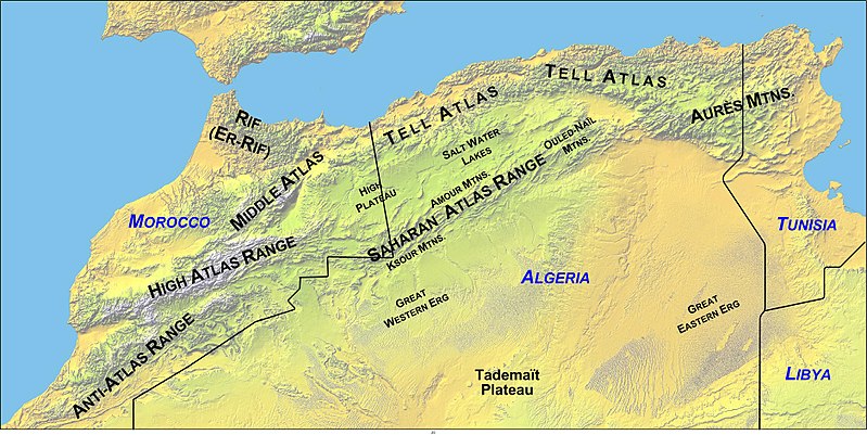
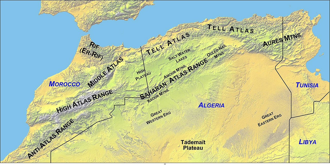
Map of North Africa showing the Atlas Mountains system's mountain ranges, with political boundaries.
- Updated Map Made by author - overlayed on "Image:Atlas (Gebirge).png" .
- Williamborg 05:07, 27 June 2006 (UTC)
Licensing[edit]
| I, the copyright holder of this work, release this work into the public domain. This applies worldwide. In some countries this may not be legally possible; if so: I grant anyone the right to use this work for any purpose, without any conditions, unless such conditions are required by law. |
File history
Click on a date/time to view the file as it appeared at that time.
| Date/Time | Thumbnail | Dimensions | User | Comment | |
|---|---|---|---|---|---|
| current | 05:00, 27 June 2006 | | 3,755 × 1,884 (1.25 MB) | Williamborg (talk | contribs) | Updated. |
| 05:32, 18 June 2006 |  | 3,751 × 1,882 (1.2 MB) | Williamborg (talk | contribs) | Edited copy of Image:Atlas (Gebirge).png with labels added. ~~~~ |
.png)
You cannot overwrite this file.
File usage on Commons
The following 3 pages use this file:
File usage on other wikis
The following other wikis use this file:
- Usage on af.wikipedia.org
- Usage on ar.wikipedia.org
- Usage on arz.wikipedia.org
- Usage on ast.wikipedia.org
- Usage on ba.wikipedia.org
- Usage on be.wikipedia.org
- Usage on bg.wikipedia.org
- Usage on ca.wikipedia.org
- Usage on ceb.wikipedia.org
- Usage on ckb.wikipedia.org
- Usage on da.wikipedia.org
- Usage on de.wikipedia.org
- Usage on el.wikipedia.org
- Usage on en.wikipedia.org
- Usage on eo.wikipedia.org
View more global usage of this file.