File:Satellite Image of Alcatraz.jpg
Jump to navigation
Jump to search

Size of this preview: 800 × 408 pixels. Other resolutions: 320 × 163 pixels | 640 × 326 pixels | 1,059 × 540 pixels.
Original file (1,059 × 540 pixels, file size: 142 KB, MIME type: image/jpeg)
Captions
Captions
Add a one-line explanation of what this file represents
| Description |
Čeština: Satelitní fotografie Alcatrazu
Deutsch: Satellitenbild von Alcatraz
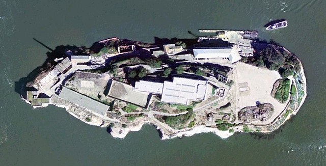
English: Satellite Image of Alcatraz
Español: Imagen de satélite de Alcatraz
Français : Photo satellite de Alcatraz |
|||
| Date | ||||
| Source | USGS Urban Area Ortho: 0.25 m - image created with NASA World Wind | |||
| Author | United States Geological Survey | |||
| Permission (Reusing this file) |
|

| Object location | | View this and other nearby images on: OpenStreetMap |
|---|
File history
Click on a date/time to view the file as it appeared at that time.
| Date/Time | Thumbnail | Dimensions | User | Comment | |
|---|---|---|---|---|---|
| current | 21:22, 12 August 2005 | | 1,059 × 540 (142 KB) | BLueFiSH.as (talk | contribs) | *{{english}} Satellite Image of Alcatraz *{{french}} Photo satellite de Alcatraz *{{german}} Satellitenbild von Alcatraz *USGS Urban Area Ortho: 0.25 m - image created with NASA World Wind {{PD-USGov-USGS}} {{World Wind}} |
You cannot overwrite this file.
File usage on Commons
The following 3 pages use this file:
File usage on other wikis
The following other wikis use this file:
- Usage on ca.wikipedia.org
- Usage on de.wikipedia.org
- Usage on es.wikipedia.org
- Usage on fr.wikipedia.org
- Usage on fr.wiktionary.org
- Usage on ja.wikipedia.org
- Usage on pl.wikipedia.org
- Usage on ro.wikipedia.org
- Usage on zh.wikipedia.org