File:KureAtoll.jpg
Jump to navigation
Jump to search

Size of this preview: 600 × 600 pixels. Other resolutions: 240 × 240 pixels | 480 × 480 pixels | 1,000 × 1,000 pixels.
Original file (1,000 × 1,000 pixels, file size: 427 KB, MIME type: image/jpeg)
Captions
Captions
Add a one-line explanation of what this file represents
Summary[edit]
| Description |
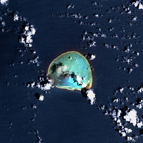
Deutsch: USGS-Landsat7-Satellitenbild des Kure-Atolls, Nordwestliche Hawaii-Inseln
English: Kure Atoll, Northwestern Hawaiian Islands - Satellite image from USGS' Landsat7 Satellite |
| Date | Unknown date |
| Source | http://www.hawaiireef.noaa.gov/imagery/rpa.html |
| Author | Landsat images were purchased by US Geological Survey |
Licensing[edit]
This image is in the public domain in the United States because it only contains materials that originally came from the United States Geological Survey, an agency of the United States Department of the Interior. For more information, see the official USGS copyright policy.
|
| This file is in the public domain in the United States because it was solely created by NASA. NASA copyright policy states that "NASA material is not protected by copyright unless noted". (See Template:PD-USGov, NASA copyright policy page or JPL Image Use Policy.) | ||
 |
Warnings:
|
Original upload log[edit]
Original Uploader was SeanMD80 (talk) at 12 March 2006.
- 03:11, 12 March 2006 . . SeanMD80 (Talk | contribs) . . 1000×1000 (556,540 bytes) (Satellite image from NASA's Landsat 7 satellite {PD-USGov-NASA} http://www.hawaiireef.noaa.gov/imagery/rpa.html )
File history
Click on a date/time to view the file as it appeared at that time.
| Date/Time | Thumbnail | Dimensions | User | Comment | |
|---|---|---|---|---|---|
| current | 22:09, 10 February 2009 | | 1,000 × 1,000 (427 KB) | Brisbane (talk | contribs) | color correction |
| 21:26, 14 May 2007 |  | 1,000 × 1,000 (543 KB) | Telim tor (talk | contribs) | == Information == {{Information |Description=25px Kure Atoll - Satellite image from USGS' Landsat7 Satellite 25px USGS-Landsat7-Satellitenbild des Kure-Atolls, Nordwestliche Hawaii-In | |
| 21:29, 12 February 2007 |  | 600 × 600 (91 KB) | Telim tor (talk | contribs) | Satellitenaufnahme des Kure-Atolls |
You cannot overwrite this file.
File usage on Commons
The following 3 pages use this file:
File usage on other wikis
The following other wikis use this file:
- Usage on als.wikipedia.org
- Usage on ca.wikipedia.org
- Usage on de.wikipedia.org
- Usage on en.wikipedia.org
- Usage on eo.wikipedia.org
- Usage on fi.wikipedia.org
- Usage on frr.wikipedia.org
- Usage on gl.wikipedia.org
- Usage on hr.wikipedia.org
- Usage on it.wikipedia.org
- Usage on ja.wikipedia.org
- Usage on lt.wikipedia.org
- Usage on no.wiktionary.org
- Usage on pt.wikipedia.org
- Usage on ru.wikipedia.org
- Usage on sh.wikipedia.org
- Usage on uk.wikipedia.org
- Usage on vi.wikipedia.org
- Usage on www.wikidata.org
- Usage on zh.wikipedia.org