File:Indien physisch-politische Karte.svg
Jump to navigation
Jump to search

Size of this PNG preview of this SVG file: 493 × 599 pixels. Other resolutions: 197 × 240 pixels | 395 × 480 pixels | 632 × 768 pixels | 842 × 1,024 pixels | 1,684 × 2,048 pixels | 1,408 × 1,712 pixels.
Original file (SVG file, nominally 1,408 × 1,712 pixels, file size: 4.77 MB)
Captions
Captions
Add a one-line explanation of what this file represents
| Description |
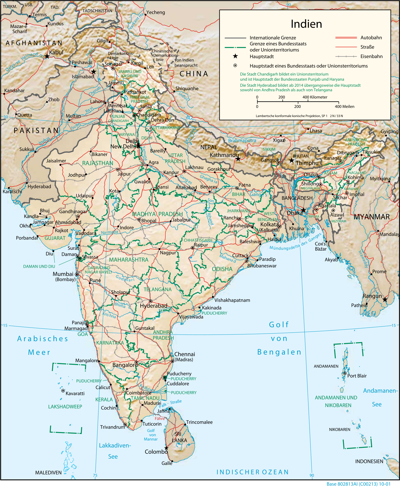
Deutsch: Physisch-geografische Karte Indiens |
|||
| Date | ||||
| Source | CIA map, modified by Furfur | |||
| Author |
|
|||
| Permission (Reusing this file) |
|

File history
Click on a date/time to view the file as it appeared at that time.
| Date/Time | Thumbnail | Dimensions | User | Comment | |
|---|---|---|---|---|---|
| current | 04:19, 16 December 2014 | | 1,408 × 1,712 (4.77 MB) | Furfur (talk | contribs) | Skalierung Details |
| 04:04, 16 December 2014 |  | 939 × 1,141 (4.71 MB) | Furfur (talk | contribs) | {{Information |Description={{de|10Physisch-geografische Karte Indiens}} |Source=[https://www.cia.gov/library/publications/the-world-factbook/docs/refmaps.html CIA map], modified by Furfur |Date=2014-12-16 |Author=*CIA *modifications mad... |
You cannot overwrite this file.
File usage on Commons
There are no pages that use this file.
File usage on other wikis
The following other wikis use this file: