File:Germany, German Democratic Republic location map w·o FRG July 1952 - October 1990.svg

Original file (SVG file, nominally 618 × 789 pixels, file size: 853 KB)
Captions
Captions
| Description |
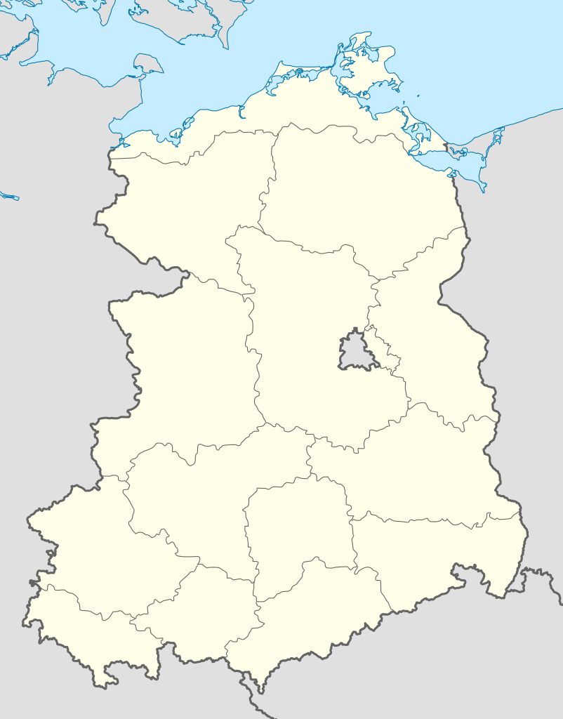
Deutsch: Positionskarte der Deutschen Demokratischen Republik im Gebietsstand von Juli 1952 bis Oktober 1990
Quadratische Plattkarte, N-S-Streckung 150 %. Geographische Begrenzung der Karte:
English: Location map of German Democratic Republic as of January 1952 till October 1990
Equirectangular projection, N/S stretching 150 %. Geographic limits of the map:
|
| Date | |
| Source |
Own work, based on: |
| Author |
TUBS |
| Other versions |
Derivative works of this file:
Bundesrepublik Deutschland (vor 1990 nur West-Deutschland):
Deutsche Demokratische Republik (mit BRD im Ausschnitt):
Ostdeutschland (vor 1990 Deutsche Demokratische Republik):
Deutschland zwischen Mai 1945 und Oktober 1949:
Thematisch:
Deutsches Reich (1918–1945) (best used with this template (de)):
|


_23_May_1949_-_6_Oct_1949.svg)


_location_map.svg)
_location_map_2013.svg)


- You are free:
- to share – to copy, distribute and transmit the work
- to remix – to adapt the work
- Under the following conditions:
- attribution – You must give appropriate credit, provide a link to the license, and indicate if changes were made. You may do so in any reasonable manner, but not in any way that suggests the licensor endorses you or your use.
- share alike – If you remix, transform, or build upon the material, you must distribute your contributions under the same or compatible license as the original.

|
Permission is granted to copy, distribute and/or modify this document under the terms of the GNU Free Documentation License, Version 1.2 or any later version published by the Free Software Foundation; with no Invariant Sections, no Front-Cover Texts, and no Back-Cover Texts. A copy of the license is included in the section entitled GNU Free Documentation License. |
File history
Click on a date/time to view the file as it appeared at that time.
| Date/Time | Thumbnail | Dimensions | User | Comment | |
|---|---|---|---|---|---|
| current | 17:03, 1 May 2010 | | 618 × 789 (853 KB) | TUBS (talk | contribs) | {{Information |Description= {{de|Positionskarte der Deutschen Demokratischen Republik im Gebietsstand von Juli 1952 bis Oktober 1990}} Quadratische Plattkarte, N-S-Streckung 150 %. Ge |
You cannot overwrite this file.
File usage on Commons
More than 100 pages use this file. The following list shows the first 100 pages that use this file only. A full list is available.
- File:DDR-Fußball-Oberliga 1952-53.jpg
- File:DDR-Fußball-Oberliga 1953-54.jpg
- File:DDR-Fußball-Oberliga 1954-55.jpg
- File:DDR-Fußball-Oberliga 1955.jpg
- File:DDR-Fußball-Oberliga 1956.jpg
- File:DDR-Fußball-Oberliga 1957.jpg
- File:DDR-Fußball-Oberliga 1958.jpg
- File:DDR-Fußball-Oberliga 1959.jpg
- File:DDR-Fußball-Oberliga 1960.PNG
- File:DDR-Fußball-Oberliga 1962.jpg
- File:DDR-Fußball-Oberliga 1963.jpg
- File:DDR-Fußball-Oberliga 1964.jpg
- File:DDR-Fußball-Oberliga 1965.jpg
- File:DDR-Fußball-Oberliga 1966.jpg
- File:DDR-Fußball-Oberliga 1967.jpg
- File:DDR-Fußball-Oberliga 1968-69.jpg
- File:DDR-Fußball-Oberliga 1968.jpg
- File:DDR-Fußball-Oberliga 1969.jpg
- File:DDR-Fußball-Oberliga 1970.jpg
- File:DDR-Fußball-Oberliga 1972.jpg
- File:DDR-Fußball-Oberliga 1975.jpg
- File:DDR-Fußball-Oberliga 1976.jpg
- File:DDR-Fußball-Oberliga 1980.jpg
- File:East Germany location map.svg
- File:Germany, Federal Republic of location map 23 May 1949 - 6 Oct 1949.svg
- File:Germany, Federal Republic of location map April 1952 - August 1955.svg
- File:Germany, Federal Republic of location map December 1950 - April 1952.svg
- File:Germany, Federal Republic of location map January 1957 - October 1990.svg
- File:Germany, Federal Republic of location map October 1949 - November 1950.svg
- File:Germany, Federal Republic of location map September 1955 - December 1956.svg
- File:Germany, German Democratic Republic location map January 1957 - October 1990.svg
- File:Germany, German Democratic Republic location map July 1952 - January 1957.svg
- File:Germany, German Democratic Republic location map October 1949 - July 1952.svg
- File:Germany, German Democratic Republic location map w·o FRG July 1952 - October 1990.svg
- File:Germany, German Democratic Republic location map w·o FRG October 1949 - June 1952.svg
- File:Germany, German Demorcratic Republic location map w·o FRG July 1952 - October 1990.svg (file redirect)
- File:Germany, location map (SBZ perspective) 23 May 1949 - 6 Oct 1949.svg
- File:Germany2 location map.svg
- File:Germany location map.svg
- File:Germany location map 23 April 1949 - 22 May 1949.svg
- File:Germany location map 8 Jun 1947 - 22 Apr 1949.svg
- File:Germany location map April 1992 - July 1992.svg
- File:Germany location map August 1992 - June 1993.svg
- File:Germany location map July 1993 - December 2009.svg
- File:Germany location map October 1990 - March 1992.svg
- File:Germany location map labeled 8 Jun 1947 - 22 Apr 1949.svg
- File:Lage Freiberg in Deutschland.png
- Template:Germany location map/other versions
- Category:1950 in the German Democratic Republic
- Category:1951 in the German Democratic Republic
- Category:1952 in the German Democratic Republic
- Category:1953 in the German Democratic Republic
- Category:1954 in the German Democratic Republic
- Category:1955 in the German Democratic Republic
- Category:1956 in the German Democratic Republic
- Category:1957 in the German Democratic Republic
- Category:1958 in the German Democratic Republic
- Category:1960 in the German Democratic Republic
- Category:1961 in the German Democratic Republic
- Category:1962 in the German Democratic Republic
- Category:1963 in the German Democratic Republic
- Category:1964 in the German Democratic Republic
- Category:1965 in the German Democratic Republic
- Category:1966 in the German Democratic Republic
- Category:1967 in the German Democratic Republic
- Category:1968 in the German Democratic Republic
- Category:1969 in the German Democratic Republic
- Category:1970 in the German Democratic Republic
- Category:1971 in the German Democratic Republic
- Category:1972 in the German Democratic Republic
- Category:1973 in the German Democratic Republic
- Category:1974 in the German Democratic Republic
- Category:1975 in the German Democratic Republic
- Category:1976 in the German Democratic Republic
- Category:1977 in the German Democratic Republic
- Category:1978 in the German Democratic Republic
- Category:1979 in the German Democratic Republic
- Category:1980 in the German Democratic Republic
- Category:1981 in the German Democratic Republic
- Category:1982 in the German Democratic Republic
- Category:1983 in the German Democratic Republic
- Category:1984 in the German Democratic Republic
- Category:1985 in the German Democratic Republic
- Category:1986 in the German Democratic Republic
- Category:1987 in the German Democratic Republic
- Category:1988 in the German Democratic Republic
- Category:1989 in the German Democratic Republic
- Category:1990 in the German Democratic Republic
- Category:Displaced persons in the German Democratic Republic
- Category:Events in the German Democratic Republic
- Category:Films of the German Democratic Republic
- Category:German Democratic Republic
- Category:German Democratic Republic in the 1950s
- Category:German Democratic Republic in the 1960s
- Category:German Democratic Republic in the 1970s
- Category:German Democratic Republic in the 1980s
- Category:Ice skating in the German Democratic Republic
- Category:International relations of the German Democratic Republic
- Category:Maps of the German Democratic Republic
- Category:Organisations of the German Democratic Republic
View more links to this file.
File usage on other wikis
The following other wikis use this file:
- Usage on ar.wikipedia.org
- Usage on ba.wikipedia.org
- Usage on ceb.wikipedia.org
- Usage on de.wikipedia.org
- Grenztruppen der DDR
- Deutsche Grenzpolizei
- Kinder- und Jugendsportschule (DDR)
- DDR-Fußball-Oberliga 1977/78
- DDR-Fußball-Oberliga 1978/79
- 16. Luftarmee
- Jagdfliegergeschwader 3
- Jagdfliegergeschwader 9
- Spezialschule mathematisch-naturwissenschaftlich-technischer Richtung
- Jagdfliegergeschwader 2
- Jagdbombenfliegergeschwader 37
- Marinefliegergeschwader 28
- A-Turm
- Zentrales Pionierlager
- DDR-Fußball-Liga 1979/80
- DDR-Fußball-Liga 1980/81
- Vorlage:Positionskarte Deutschland Neue Bundesländer
- DDR-Fußball-Liga 1981/82
- DDR-Fußball-Liga 1982/83
- DDR-Fußball-Liga 1983/84
- DDR-Fußball-Liga 1984/85
- 9. Panzerdivision (NVA)
- 7. Panzerdivision (NVA)
- 11. Mot.-Schützendivision (NVA)
- DDR-Fußball-Liga 1985/86
- DDR-Fußball-Liga 1986/87
- DDR-Fußball-Liga 1987/88
- DDR-Fußball-Liga 1988/89
- DDR-Fußball-Liga 1989/90
- 4. Mot.-Schützendivision (NVA)
- 8. Mot.-Schützendivision (NVA)
- 1. Mot.-Schützendivision (NVA)
- 6. Mot.-Schützendivision (NVA)
- Transportfliegergeschwader 44
- Jagdbombenfliegergeschwader 77
- II. DDR-Liga 1955
- II. DDR-Liga 1956
- II. DDR-Liga 1957
- DDR-Fußball-Liga 1950/51
- DDR-Fußball-Liga 1957
- DDR-Fußball-Liga 1956
- DDR-Fußball-Liga 1951/52
- 1. Luftverteidigungsdivision (NVA)
- 3. Luftverteidigungsdivision (NVA)
- Grenzschutz der DDR
- DDR-Fußball-Liga 1955
View more global usage of this file.