File:Map of Russian districts, 2016-07-28.svg
Jump to navigation
Jump to search

Size of this PNG preview of this SVG file: 800 × 462 pixels. Other resolutions: 320 × 185 pixels | 640 × 369 pixels | 1,024 × 591 pixels | 1,280 × 738 pixels | 2,560 × 1,477 pixels | 1,092 × 630 pixels.
Original file (SVG file, nominally 1,092 × 630 pixels, file size: 273 KB)
Captions
Captions
Add a one-line explanation of what this file represents

|
The boundaries on this map show the de facto situation. This is just one of several different views on the subject (see COM:NPOV). |
Summary[edit]
| Description |
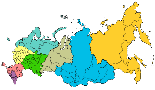
Русский: Map of Russian federal districts as for 2016-07-28 |
| Date | |
| Source |
 |
| Author | User:Insider |
Licensing[edit]
This file is licensed under the Creative Commons Attribution-Share Alike 2.5 Generic license.
- You are free:
- to share – to copy, distribute and transmit the work
- to remix – to adapt the work
- Under the following conditions:
- attribution – You must give appropriate credit, provide a link to the license, and indicate if changes were made. You may do so in any reasonable manner, but not in any way that suggests the licensor endorses you or your use.
- share alike – If you remix, transform, or build upon the material, you must distribute your contributions under the same or compatible license as the original.
File history
Click on a date/time to view the file as it appeared at that time.
| Date/Time | Thumbnail | Dimensions | User | Comment | |
|---|---|---|---|---|---|
| current | 22:16, 16 October 2016 | | 1,092 × 630 (273 KB) | Turnless (talk | contribs) | Fix |
| 13:59, 29 July 2016 |  | 1,092 × 630 (271 KB) | AlexWelens (talk | contribs) | Moscow expansion added... | |
| 13:26, 29 July 2016 |  | 1,092 × 630 (271 KB) | AlexWelens (talk | contribs) | Moscow expansion added | |
| 11:44, 28 July 2016 |  | 1,092 × 630 (271 KB) | AlexWelens (talk | contribs) | User created page with UploadWizard |
You cannot overwrite this file.
File usage on Commons
The following 2 pages use this file:
- Atlas of Russia
- File:Map of Russian districts, 2016-07-28 (2).svg (file redirect)
.svg&redirect=no)
File usage on other wikis
The following other wikis use this file:
- Usage on ast.wikipedia.org
- Usage on be-tarask.wikipedia.org
- Usage on be.wikipedia.org
- Usage on bs.wikipedia.org
- Usage on cs.wikipedia.org
- Usage on da.wikipedia.org
- Usage on de.wikipedia.org
- Usage on en.wikipedia.org
- Usage on es.wikipedia.org
- Usage on eu.wikipedia.org
- Usage on fa.wikipedia.org
- Usage on frr.wikipedia.org
- Usage on fr.wikipedia.org
- Usage on he.wikipedia.org
- Usage on it.wikipedia.org
- Usage on ja.wikipedia.org
- Usage on kk.wikipedia.org
- Usage on ms.wikipedia.org
- Usage on nl.wikipedia.org
- Usage on no.wikipedia.org
- Usage on pnb.wikipedia.org
- Usage on pt.wikipedia.org
- Usage on sl.wikipedia.org
- Usage on th.wikipedia.org
- Usage on tt.wikipedia.org
- Usage on ur.wikipedia.org
- Usage on uz.wikipedia.org
- Usage on vls.wikipedia.org