File:Finland 1996 CIA map.jpg
Jump to navigation
Jump to search
Size of this preview: 498 × 599 pixels. Other resolutions: 199 × 240 pixels | 399 × 480 pixels | 638 × 768 pixels | 851 × 1,024 pixels | 1,662 × 2,000 pixels.
Original file (1,662 × 2,000 pixels, file size: 2.5 MB, MIME type: image/jpeg)
Captions
Captions
Add a one-line explanation of what this file represents
| Description |
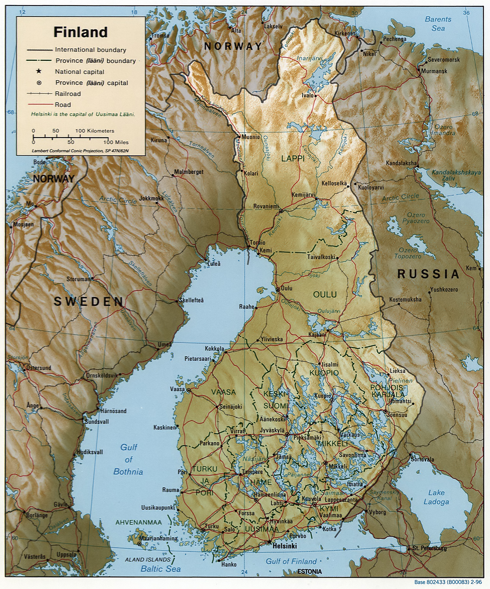
English: Map of Finland, relief shown by shading. Scale [ca. 1:6,250,000]; Lambert conformal conic proj. (E 180--E 340/N 720--N 590); map 20 x 17 cm; "Base 802433 (B00083) 2-96." |
|||
| Date | ||||
| Source |
REPOSITORY Library of Congress Geography and Map Division Washington, D.C. 20540-4650 USA DIGITAL ID g6960 ct001018 http://hdl.loc.gov/loc.gmd/g6960.ct001018 CALL NUMBER G6960 1996 .U6 |
|||
| Author | Central Intelligence Agency, Washington, D.C., United States. | |||
| Permission (Reusing this file) |
|

File history
Click on a date/time to view the file as it appeared at that time.
| Date/Time | Thumbnail | Dimensions | User | Comment | |
|---|---|---|---|---|---|
| current | 12:48, 19 February 2007 | | 1,662 × 2,000 (2.5 MB) | Zarex (talk | contribs) | reduced the noise |
| 08:26, 27 October 2005 |  | 1,662 × 2,000 (1.5 MB) | Brian0918 (talk | contribs) | Finland. United States. Central Intelligence Agency. CREATED/PUBLISHED [Washington, D.C. : Central Intelligence Agency, 1996] NOTES Relief shown by shading. "Base 802433 (B00083) 2-96." Also issued without shaded relief. Scale [ca. 1:6,250,000] ; La |
You cannot overwrite this file.
File usage on Commons
The following 3 pages use this file:
File usage on other wikis
The following other wikis use this file:
- Usage on as.wikipedia.org
- Usage on az.wiktionary.org
- Usage on be.wikipedia.org
- Usage on bg.wikipedia.org
- Usage on bjn.wikipedia.org
- Usage on bug.wikipedia.org
- Usage on ch.wikipedia.org
- Usage on da.wikipedia.org
- Usage on de.wikipedia.org
- Usage on en.wikipedia.org
- Usage on en.wiktionary.org
- Usage on es.wikipedia.org
- Usage on fa.wikipedia.org
- Usage on fi.wikinews.org
- Usage on fj.wikipedia.org
- Usage on fr.wikipedia.org
- Usage on gl.wikipedia.org
- Usage on hu.wikipedia.org
- Usage on id.wikipedia.org
- Usage on ig.wikipedia.org
- Usage on io.wikipedia.org
- Usage on it.wikipedia.org
- Usage on kn.wikipedia.org
- Usage on ks.wikipedia.org
- Usage on lbe.wikipedia.org
- Usage on map-bms.wikipedia.org
- Usage on mdf.wikipedia.org
- Usage on min.wikipedia.org
- Usage on nn.wikipedia.org
- Usage on no.wikipedia.org
- Usage on nso.wikipedia.org
- Usage on pfl.wikipedia.org
- Usage on pl.wikipedia.org
- Usage on pt.wikipedia.org
- Usage on rn.wikipedia.org
- Usage on ro.wikipedia.org
- Usage on ru.wikipedia.org
- Usage on sd.wikipedia.org
- Usage on sg.wikipedia.org
- Usage on sg.wiktionary.org
View more global usage of this file.