File:USA Puerto Rico location map.svg
Jump to navigation
Jump to search

Size of this PNG preview of this SVG file: 800 × 450 pixels. Other resolutions: 320 × 180 pixels | 640 × 360 pixels | 1,024 × 576 pixels | 1,280 × 720 pixels | 2,560 × 1,440 pixels | 1,058 × 595 pixels.
Original file (SVG file, nominally 1,058 × 595 pixels, file size: 114 KB)
Captions
Captions
Add a one-line explanation of what this file represents
Summary[edit]
| Description |
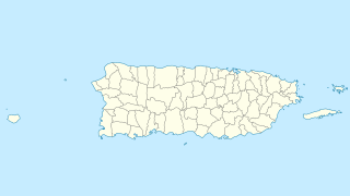
Quadratische Plattkarte, N-S-Streckung 105 %. Geographische Begrenzung der Karte:
Equirectangular projection, N/S stretching 105 %. Geographic limits of the map:
|
| Date | |
| Source | own work, using U.S. Geological Survey (USGS) data |
| Author | NordNordWest |
| Other versions |
|


|
This map has been made or improved in the German Kartenwerkstatt (Map Lab). You can propose maps to improve as well.
|
Licensing[edit]
I, the copyright holder of this work, hereby publish it under the following license:
This file is licensed under the Creative Commons Attribution-Share Alike 3.0 Unported license.
- You are free:
- to share – to copy, distribute and transmit the work
- to remix – to adapt the work
- Under the following conditions:
- attribution – You must give appropriate credit, provide a link to the license, and indicate if changes were made. You may do so in any reasonable manner, but not in any way that suggests the licensor endorses you or your use.
- share alike – If you remix, transform, or build upon the material, you must distribute your contributions under the same or compatible license as the original.
File history
Click on a date/time to view the file as it appeared at that time.
| Date/Time | Thumbnail | Dimensions | User | Comment | |
|---|---|---|---|---|---|
| current | 07:13, 19 June 2009 | | 1,058 × 595 (114 KB) | NordNordWest (talk | contribs) | {{Information |Description= {{de|Positionskarte von Puerto Rico, USA}} Quadratische Plattkarte, N-S-Streckung 105 %. Geographische Begrenzung der Karte: * N: 19.0° N * S: 17.5° N * W: 68.0° W * O: 65.2° W {{en|Location |
You cannot overwrite this file.
File usage on Commons
More than 100 pages use this file. The following list shows the first 100 pages that use this file only. A full list is available.
- Puerto Rico
- User:NordNordWest/Gallery/Location maps
- File:Mapa del Caribe (límites marinos).svg
- File:Popular footprint.png
- File:Porta Caribe.svg
- File:Puerto Rico Soccer League Teams Map.png
- File:Starbucks footprint.png
- File:USA Puerto Rico labeled.svg
- File:United States (+overseas), administrative divisions - Nmbrs (marker).svg
- File:United States (+overseas), administrative divisions - Nmbrs (zoom).svg
- File:United States (+overseas), administrative divisions - Nmbrs - colored (marker).svg
- File:United States (+overseas), administrative divisions - Nmbrs - colored (zoom).svg
- File:United States (+overseas), administrative divisions - XY (marker).svg
- File:United States (+overseas), administrative divisions - XY (zoom).svg
- File:United States (+overseas), administrative divisions - XY - colored (marker).svg
- File:United States (+overseas), administrative divisions - XY - colored (zoom).svg
- File:United States (+overseas), administrative divisions - de (marker).svg
- File:United States (+overseas), administrative divisions - de (zoom).svg
- File:United States (+overseas), administrative divisions - de - colored (marker).svg
- File:United States (+overseas), administrative divisions - de - colored (zoom).svg
- Category:1898 in Puerto Rico
- Category:1899 in Puerto Rico
- Category:1900 in Puerto Rico
- Category:1941 in Puerto Rico
- Category:1972 in Puerto Rico
- Category:1973 in Puerto Rico
- Category:1975 in Puerto Rico
- Category:1987 in Puerto Rico
- Category:1998 in Puerto Rico
- Category:2004 in Puerto Rico
- Category:2006 in Puerto Rico
- Category:2007 in Puerto Rico
- Category:2009 in Puerto Rico
- Category:2010 in Puerto Rico
- Category:2011 in Puerto Rico
- Category:2012 in Puerto Rico
- Category:Actors from Puerto Rico
- Category:Airports in Puerto Rico
- Category:Alumni by university or college in Puerto Rico
- Category:Archaeological sites in Puerto Rico
- Category:Archbishops from Puerto Rico
- Category:Association football clubs in Puerto Rico
- Category:Association football players from Puerto Rico
- Category:Athletics competitors from Puerto Rico
- Category:Basketball in Puerto Rico
- Category:Basketball players from Puerto Rico
- Category:Beaches of Puerto Rico
- Category:Bishops from Puerto Rico
- Category:Boxers from Puerto Rico
- Category:Bridges in Puerto Rico
- Category:Cemeteries in Puerto Rico
- Category:Churches in Puerto Rico
- Category:Composers from Puerto Rico
- Category:Dams in Puerto Rico
- Category:Dancers from Puerto Rico
- Category:Energy in Puerto Rico
- Category:Events in Puerto Rico
- Category:Figure skaters from Puerto Rico
- Category:Flora of Puerto Rico
- Category:Golf in Puerto Rico
- Category:Islands of Puerto Rico
- Category:Journalists from Puerto Rico
- Category:Landforms of Puerto Rico
- Category:Lighthouses in Puerto Rico
- Category:Maps of Puerto Rico
- Category:Metropolitan areas of Puerto Rico
- Category:Mosques in Puerto Rico
- Category:Musical instruments of Puerto Rico
- Category:Musicians from Puerto Rico
- Category:National Forests of Puerto Rico
- Category:Nature of Puerto Rico
- Category:Parks in Puerto Rico
- Category:Physicians from Puerto Rico
- Category:Protected areas of Puerto Rico
- Category:Puerto Rico
- Category:Puerto Rico by decade
- Category:Puerto Rico by year
- Category:Puerto Rico in the 1850s
- Category:Puerto Rico in the 1890s
- Category:Puerto Rico in the 1940s
- Category:Puerto Rico in the 1970s
- Category:Puerto Rico in the 1980s
- Category:Puerto Rico in the 1990s
- Category:Puerto Rico in the 19th century
- Category:Puerto Rico in the 2000s
- Category:Puerto Rico in the 2010s
- Category:Puerto Rico in the 20th century
- Category:Puerto Rico in the 21st century
- Category:Rail tunnels in Puerto Rico
- Category:Rivers of Puerto Rico
- Category:Roads in Puerto Rico
- Category:Roman Catholic dioceses in Puerto Rico
- Category:Scientists from Puerto Rico
- Category:Sports venues in Puerto Rico
- Category:Templates related to Puerto Rico
- Category:Tennis players from Puerto Rico
- Category:Theaters in Puerto Rico
- Category:Tunnels in Puerto Rico
- Category:Water transport in Puerto Rico
- Category:World Heritage Sites in Puerto Rico
.svg)
,_administrative_divisions_-_Nmbrs_(marker).svg)
,_administrative_divisions_-_Nmbrs_(zoom).svg)
,_administrative_divisions_-_Nmbrs_-_colored_(marker).svg)
,_administrative_divisions_-_Nmbrs_-_colored_(zoom).svg)
,_administrative_divisions_-_XY_(marker).svg)
,_administrative_divisions_-_XY_(zoom).svg)
,_administrative_divisions_-_XY_-_colored_(marker).svg)
,_administrative_divisions_-_XY_-_colored_(zoom).svg)
,_administrative_divisions_-_de_(marker).svg)
,_administrative_divisions_-_de_(zoom).svg)
,_administrative_divisions_-_de_-_colored_(marker).svg)
,_administrative_divisions_-_de_-_colored_(zoom).svg)
View more links to this file.
File usage on other wikis
The following other wikis use this file:
- Usage on af.wikipedia.org
- Usage on an.wikipedia.org
- Usage on ar.wikipedia.org
- Usage on ast.wikipedia.org
- Usage on azb.wikipedia.org
- Usage on az.wikipedia.org
- Usage on be.wikipedia.org
- Usage on bg.wikipedia.org
- Usage on ca.wikipedia.org
- Usage on ceb.wikipedia.org
View more global usage of this file.