File:Prussian Lithuania (A. Dury, 1763).jpg
Jump to navigation
Jump to search
Size of this preview: 492 × 600 pixels. Other resolutions: 197 × 240 pixels | 394 × 480 pixels | 630 × 768 pixels | 840 × 1,024 pixels | 1,374 × 1,675 pixels.
Original file (1,374 × 1,675 pixels, file size: 1.87 MB, MIME type: image/jpeg)
Captions
Captions
Add a one-line explanation of what this file represents
Summary[edit]
.jpg&action=edit§ion=1)
| Description |
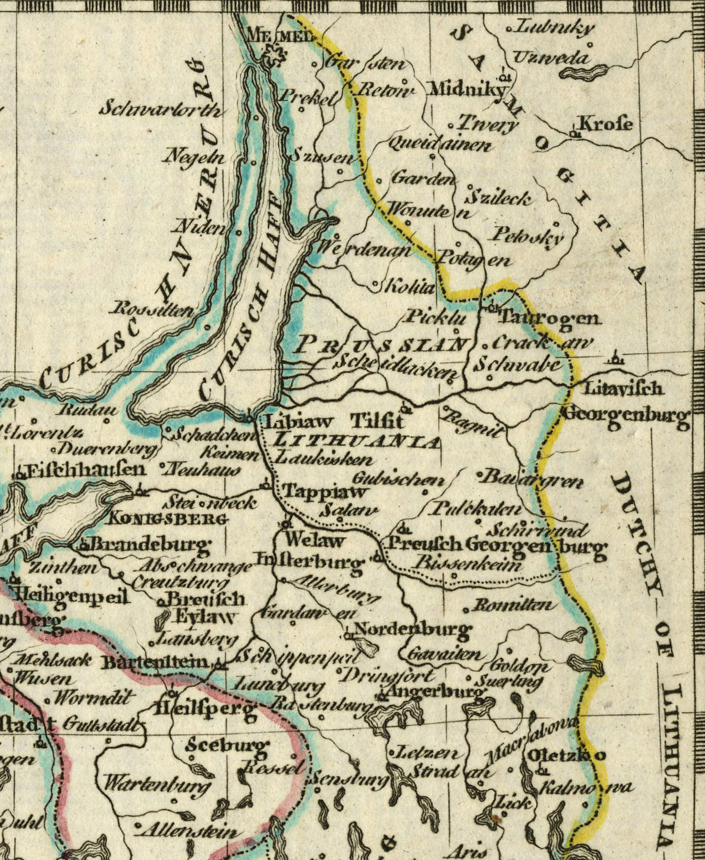
Беларуская (тарашкевіца): Жамойць літоўская (Samogitia) і пруская (Prussian Lithuania). Мапа, фрагмэнт |
| Date | |
| Source |
Kingdom of Prussia A New General and Universal Atlas Containing Forty five Maps By Andrew Dury. Engraved by Mr. Kitchin & others |
| Author | Andrew Dury |
Licensing[edit]
.jpg&action=edit§ion=2)
|
This work is in the public domain in its country of origin and other countries and areas where the copyright term is the author's life plus 100 years or fewer. | |
| This file has been identified as being free of known restrictions under copyright law, including all related and neighboring rights. | |
File history
Click on a date/time to view the file as it appeared at that time.
| Date/Time | Thumbnail | Dimensions | User | Comment | |
|---|---|---|---|---|---|
| current | 21:13, 14 December 2021 | | 1,374 × 1,675 (1.87 MB) | Kazimier Lachnovič (talk | contribs) | == {{int:filedesc}} == {{Information |Description ={{be-tarask|1=Жамойць літоўская (Samogitia) і пруская (Prussian Litauen). Мапа, фрагмэнт}} |Source =Kingdom of Prussia <br> A New General and Universal Atlas Containing Forty five Maps By Andrew Dury. Engraved by Mr. Kitchin & others |Author =Andrew Dury |Date =1763 |other_versions= }} == {{int:license-header}} == {{PD-old-100}} Category:History maps of Samogitia... |
You cannot overwrite this file.
File usage on Commons
There are no pages that use this file.
File usage on other wikis
The following other wikis use this file:
- Usage on be-tarask.wikipedia.org
.jpg&oldid=613971557)