File:Moscow satellite image.jpeg
Jump to navigation
Jump to search
Size of this preview: 600 × 600 pixels. Other resolutions: 240 × 240 pixels | 480 × 480 pixels | 1,000 × 1,000 pixels.
Original file (1,000 × 1,000 pixels, file size: 396 KB, MIME type: image/jpeg)
Captions
Captions
Add a one-line explanation of what this file represents
Summary[edit]
| Description |
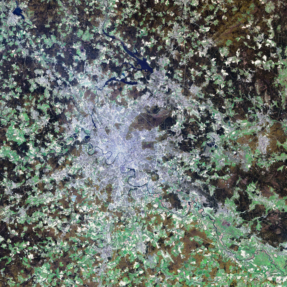
Deutsch: Satellitenbild von de:Moskau English: satellite image of the city of en:Moscow.
|
| Date | 2 August 2002 |
| Source | NASA Visible Earth project, http://visibleearth.nasa.gov/view_rec.php?id=3434 |
| Author | NASA/USGS EROS Data Center Satellite Systems Branch/Landsat 7/ETM+ |
Licensing[edit]
This image is in the public domain in the United States because it only contains materials that originally came from the United States Geological Survey, an agency of the United States Department of the Interior. For more information, see the official USGS copyright policy.
|
| This file is in the public domain in the United States because it was solely created by NASA. NASA copyright policy states that "NASA material is not protected by copyright unless noted". (See Template:PD-USGov, NASA copyright policy page or JPL Image Use Policy.) | ||
 |
Warnings:
|
File history
Click on a date/time to view the file as it appeared at that time.
| Date/Time | Thumbnail | Dimensions | User | Comment | |
|---|---|---|---|---|---|
| current | 05:12, 8 November 2004 | | 1,000 × 1,000 (396 KB) | Ævar Arnfjörð Bjarmason (talk | contribs) |
You cannot overwrite this file.
File usage on Commons
The following page uses this file:
File usage on other wikis
The following other wikis use this file:
- Usage on af.wikipedia.org
- Usage on ar.wikipedia.org
- Usage on be-tarask.wikipedia.org
- Usage on ca.wikipedia.org
- Usage on hif.wikipedia.org
- Usage on hr.wikipedia.org
- Usage on hu.wiktionary.org
- Usage on it.wikipedia.org
- Usage on kk.wikipedia.org
- Usage on lb.wikipedia.org
- Usage on my.wikipedia.org
- Usage on roa-tara.wikipedia.org
- Usage on ru.wikipedia.org
- Usage on sh.wikipedia.org
- Usage on sl.wikipedia.org
- Usage on yi.wikipedia.org