File:Ruanda 2007 de.svg

Original file (SVG file, nominally 981 × 729 pixels, file size: 246 KB)
Captions
Captions
Summary[edit]
| Description |
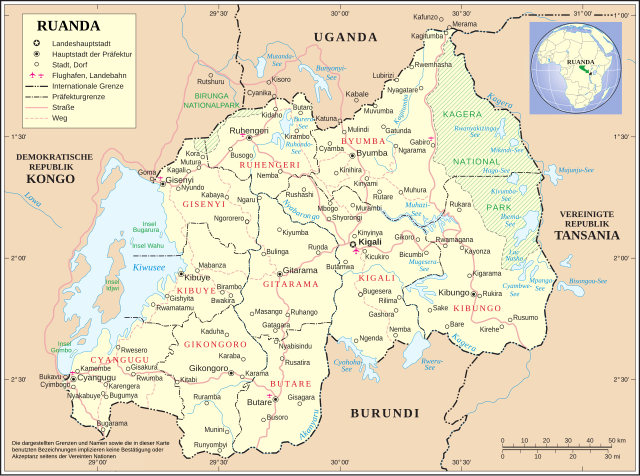
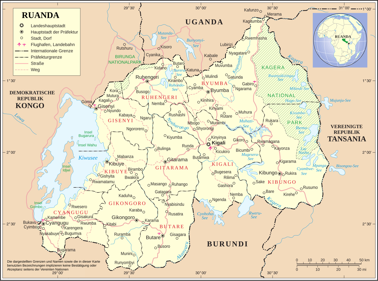
Deutsch: Karte Ruandas nach Verwaltungsreform im Jahr 2006
English: Map of Rwanda after administrative reform of 2006 (german) |
|||
| Date | ||||
| Source | Image:Un-rwanda.png http://www.un.org/Depts/Cartographic/english/htmain.htm | |||
| Author | Image:Ruanda deutsch UNO-Karte.jpg + UN Original changed to SVG + new province | |||
| Permission (Reusing this file) |
|
|||
| Other versions |
|
|||
| SVG development |


File history
Click on a date/time to view the file as it appeared at that time.
| Date/Time | Thumbnail | Dimensions | User | Comment | |
|---|---|---|---|---|---|
| current | 22:01, 23 September 2018 | | 981 × 729 (246 KB) | JoKalliauer (talk | contribs) | corrected marings |
| 00:20, 12 August 2018 |  | 981 × 729 (432 KB) | Furfur (talk | contribs) | Kiwusee | |
| 05:56, 1 April 2016 |  | 967 × 716 (433 KB) | Wereldburger758 (talk | contribs) | Scale raised to the layer above. Removed border. No librsvg error detected. Validation of image. | |
| 12:52, 26 June 2009 |  | 990 × 765 (450 KB) | FischX (talk | contribs) | fix | |
| 12:47, 26 June 2009 |  | 990 × 765 (451 KB) | FischX (talk | contribs) | fix | |
| 12:40, 26 June 2009 |  | 990 × 765 (450 KB) | FischX (talk | contribs) | fix2 | |
| 12:22, 26 June 2009 |  | 990 × 765 (705 KB) | FischX (talk | contribs) | fix | |
| 09:24, 9 February 2009 |  | 990 × 765 (730 KB) | Martin H. (talk | contribs) | Reverted to version as of 00:57, 26 February 2008, not better, looks awful in the total view | |
| 09:21, 9 February 2009 |  | 990 × 765 (574 KB) | Martin H. (talk | contribs) | Reverted to version as of 21:47, 25 February 2008, looks awful in miniature in IE and Firefox, city names are all on the left side | |
| 00:57, 26 February 2008 |  | 990 × 765 (730 KB) | FischX (talk | contribs) | +Topic Layer |
You cannot overwrite this file.
File usage on Commons
The following 4 pages use this file:
File usage on other wikis
The following other wikis use this file:
- Usage on nds.wikipedia.org
- Usage on uz.wikipedia.org