File:Guinea from Milner's Atlas.jpg
Jump to navigation
Jump to search

Size of this preview: 800 × 569 pixels. Other resolutions: 320 × 228 pixels | 640 × 455 pixels | 1,008 × 717 pixels.
Original file (1,008 × 717 pixels, file size: 1.24 MB, MIME type: image/jpeg)
Captions
Captions
Add a one-line explanation of what this file represents
Summary[edit]
| Description |
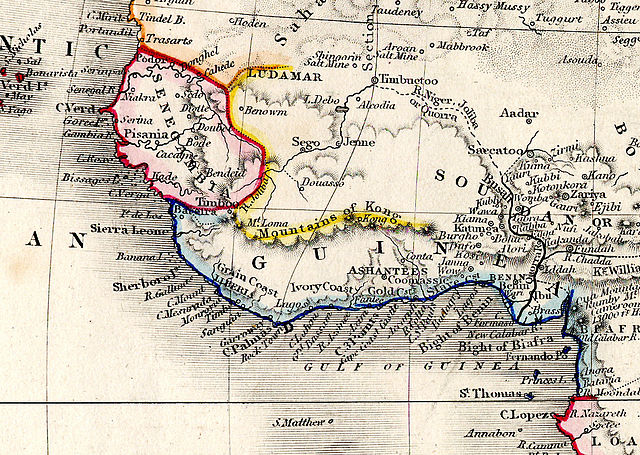
English: Detail showing Guinea and surrounding regions, from "Africa" plate of Milner's Descriptive Atlas |
| Date | |
| Source | Own work |
| Author | Rev. Thomas Milner |
Licensing[edit]
I, the copyright holder of this work, hereby publish it under the following licenses:
This file is licensed under the Creative Commons Attribution-Share Alike 3.0 Unported license.
- You are free:
- to share – to copy, distribute and transmit the work
- to remix – to adapt the work
- Under the following conditions:
- attribution – You must give appropriate credit, provide a link to the license, and indicate if changes were made. You may do so in any reasonable manner, but not in any way that suggests the licensor endorses you or your use.
- share alike – If you remix, transform, or build upon the material, you must distribute your contributions under the same or compatible license as the original.

|
Permission is granted to copy, distribute and/or modify this document under the terms of the GNU Free Documentation License, Version 1.2 or any later version published by the Free Software Foundation; with no Invariant Sections, no Front-Cover Texts, and no Back-Cover Texts. A copy of the license is included in the section entitled GNU Free Documentation License. |
You may select the license of your choice.
File history
Click on a date/time to view the file as it appeared at that time.
| Date/Time | Thumbnail | Dimensions | User | Comment | |
|---|---|---|---|---|---|
| current | 18:51, 5 November 2012 | | 1,008 × 717 (1.24 MB) | Maproom (talk | contribs) | {{Information |Description ={{en|1=Detail showing Guinea and surrounding regions, from "Africa" plate of Milner's Descriptive Atlas}} |Source =Own work |Author =Rev. Thomas Milner |Date =1850 |Permission = |other_versio... |
You cannot overwrite this file.
File usage on Commons
There are no pages that use this file.
File usage on other wikis
The following other wikis use this file:
- Usage on ast.wikipedia.org
- Usage on bn.wikipedia.org
- Usage on en.wikipedia.org
- Usage on es.wikipedia.org
- Usage on eu.wikipedia.org
- Usage on ja.wikipedia.org
- Usage on mk.wikipedia.org
- Usage on pt.wikipedia.org
- Usage on si.wikipedia.org
- Usage on te.wikipedia.org
- Usage on tr.wikipedia.org
- Usage on vi.wikipedia.org
- Usage on yo.wikipedia.org
Categories:
- 19th-century maps of West Africa
- 1850 maps of Africa
- Mountains of Africa
- English-language maps
- 19th-century maps of Guinea
- 19th-century maps of Senegal
- 19th-century maps of Mauritania
- 19th-century maps of Mali
- 19th-century maps of Liberia
- 19th-century maps of Nigeria
- 19th-century maps of Sierra Leone
- 19th-century maps of Ivory Coast
- 19th-century maps of Ghana
- 19th-century maps of Togo
- Mountains of Kong
- Senegambia region