File:Sikkim locator map.svg
Jump to navigation
Jump to search

Size of this PNG preview of this SVG file: 424 × 600 pixels. Other resolutions: 170 × 240 pixels | 339 × 480 pixels | 543 × 768 pixels | 724 × 1,024 pixels | 1,448 × 2,048 pixels | 1,595 × 2,256 pixels.
Original file (SVG file, nominally 1,595 × 2,256 pixels, file size: 244 KB)
Captions
Captions
Add a one-line explanation of what this file represents
| Title |
Sikkim locator map |
||
| Description |
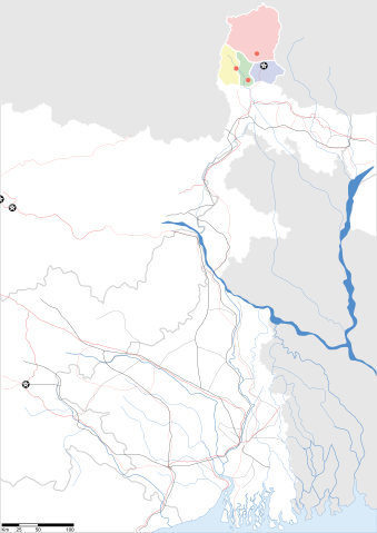
Map of w:Sikkim with road and rail lines. Equirectangular projection. Geographic limits of the map: top=28.15, bottom=21.48, left=84.99, right=90.15. |
||
| Date | |||
| Source |
Own work |
||
| Creator |
|
||
| Permission (Reusing this file) |
I, the copyright holder of this work, hereby publish it under the following license: This file is licensed under the Creative Commons Attribution-Share Alike 3.0 Unported license.
|
||
| Geotemporal data | |||
| Date depicted | second half of 20th century and 21st century | ||
| Georeferencing | If inappropriate please set warp_status = skip to hide. | ||
| Archival data | |||
| Notes | Part of WikiProject India Maps | ||
File history
Click on a date/time to view the file as it appeared at that time.
| Date/Time | Thumbnail | Dimensions | User | Comment | |
|---|---|---|---|---|---|
| current | 09:58, 12 May 2007 | | 1,595 × 2,256 (244 KB) | Planemad (talk | contribs) | border fix |
| 19:20, 7 May 2007 |  | 1,595 × 2,256 (252 KB) | Planemad (talk | contribs) | border | |
| 19:14, 7 May 2007 |  | 1,595 × 2,256 (245 KB) | Planemad (talk | contribs) | {{WikiProject_India_Maps |Title=Gujarat locator map.svg locator map |Description=Map of w:Gujarat locator map.svg with road and rail lines. |Source= |Date=May 2007 |Author=w:user:Planemad }} Category:WikiProject India State Maps |
You cannot overwrite this file.
File usage on Commons
The following 2 pages use this file:
File usage on other wikis
The following other wikis use this file:
- Usage on as.wikipedia.org
- Usage on be.wikipedia.org
- Usage on de.wikipedia.org
- Usage on dty.wikipedia.org
- Usage on en.wikipedia.org
- Usage on es.wikipedia.org
- Usage on fa.wikipedia.org
- Usage on gu.wikipedia.org
- Usage on hi.wikipedia.org
- Usage on lv.wikipedia.org
- Usage on mai.wikipedia.org
- Usage on ml.wikipedia.org
- Usage on ms.wikipedia.org
- Usage on or.wikipedia.org
- Usage on pam.wikipedia.org
- Usage on pnb.wikipedia.org
- Usage on sw.wikipedia.org
- Usage on ta.wikipedia.org
- Usage on uk.wikipedia.org
- Usage on vi.wikipedia.org
- Usage on yo.wikipedia.org