File:Koppen-Geiger Map NGA present-ar.svg
Jump to navigation
Jump to search

Size of this PNG preview of this SVG file: 800 × 476 pixels. Other resolutions: 320 × 190 pixels | 640 × 380 pixels | 1,024 × 609 pixels | 1,280 × 761 pixels | 2,560 × 1,522 pixels | 1,430 × 850 pixels.
Original file (SVG file, nominally 1,430 × 850 pixels, file size: 1.45 MB)
Captions
Captions
Add a one-line explanation of what this file represents
Summary[edit]
| Description |
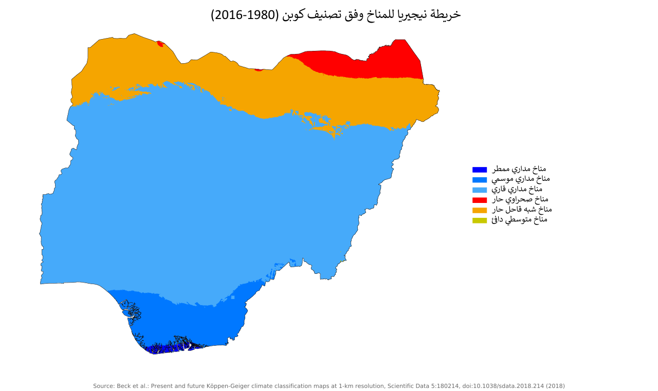
العربية: خريطة نيجيريا وفق تصنيف كوبن للمناخ
English: Köppen–Geiger climate classification map for Nigeria |
| Date | |
| Source | "Present and future Köppen-Geiger climate classification maps at 1-km resolution". Nature Scientific Data. DOI:10.1038/sdata.2018.214. |
| Author |
Sandra, This file was derived from: Koppen-Geiger Map NGA present.svg |
| SVG development | This vector image was created with Inkscape. This file uses embedded text that can be easily translated using a text editor. |
| This is a retouched picture, which means that it has been digitally altered from its original version. Modifications: Translated to Arabic - عُرِبَت. The original can be viewed here: Koppen-Geiger Map NGA present.svg:
|
Licensing[edit]
This file is licensed under the Creative Commons Attribution 4.0 International license.
Attribution: Beck, H.E., Zimmermann, N. E., McVicar, T. R., Vergopolan, N., Berg, A., & Wood, E. F.
- You are free:
- to share – to copy, distribute and transmit the work
- to remix – to adapt the work
- Under the following conditions:
- attribution – You must give appropriate credit, provide a link to the license, and indicate if changes were made. You may do so in any reasonable manner, but not in any way that suggests the licensor endorses you or your use.
| Camera location | | View this and other nearby images on: OpenStreetMap |
|---|
File history
Click on a date/time to view the file as it appeared at that time.
| Date/Time | Thumbnail | Dimensions | User | Comment | |
|---|---|---|---|---|---|
| current | 23:09, 19 March 2021 | | 1,430 × 850 (1.45 MB) | Sandra Hanbo (talk | contribs) | Uploaded own work with UploadWizard |
You cannot overwrite this file.
File usage on Commons
There are no pages that use this file.
File usage on other wikis
The following other wikis use this file:
- Usage on ar.wikipedia.org