File:Desertification map-ar.jpg
Jump to navigation
Jump to search
Size of this preview: 800 × 518 pixels. Other resolutions: 320 × 207 pixels | 640 × 414 pixels | 1,024 × 663 pixels | 1,280 × 828 pixels | 1,700 × 1,100 pixels.
Original file (1,700 × 1,100 pixels, file size: 435 KB, MIME type: image/jpeg)
Captions
Captions
Add a one-line explanation of what this file represents
Summary[edit]
| Description |
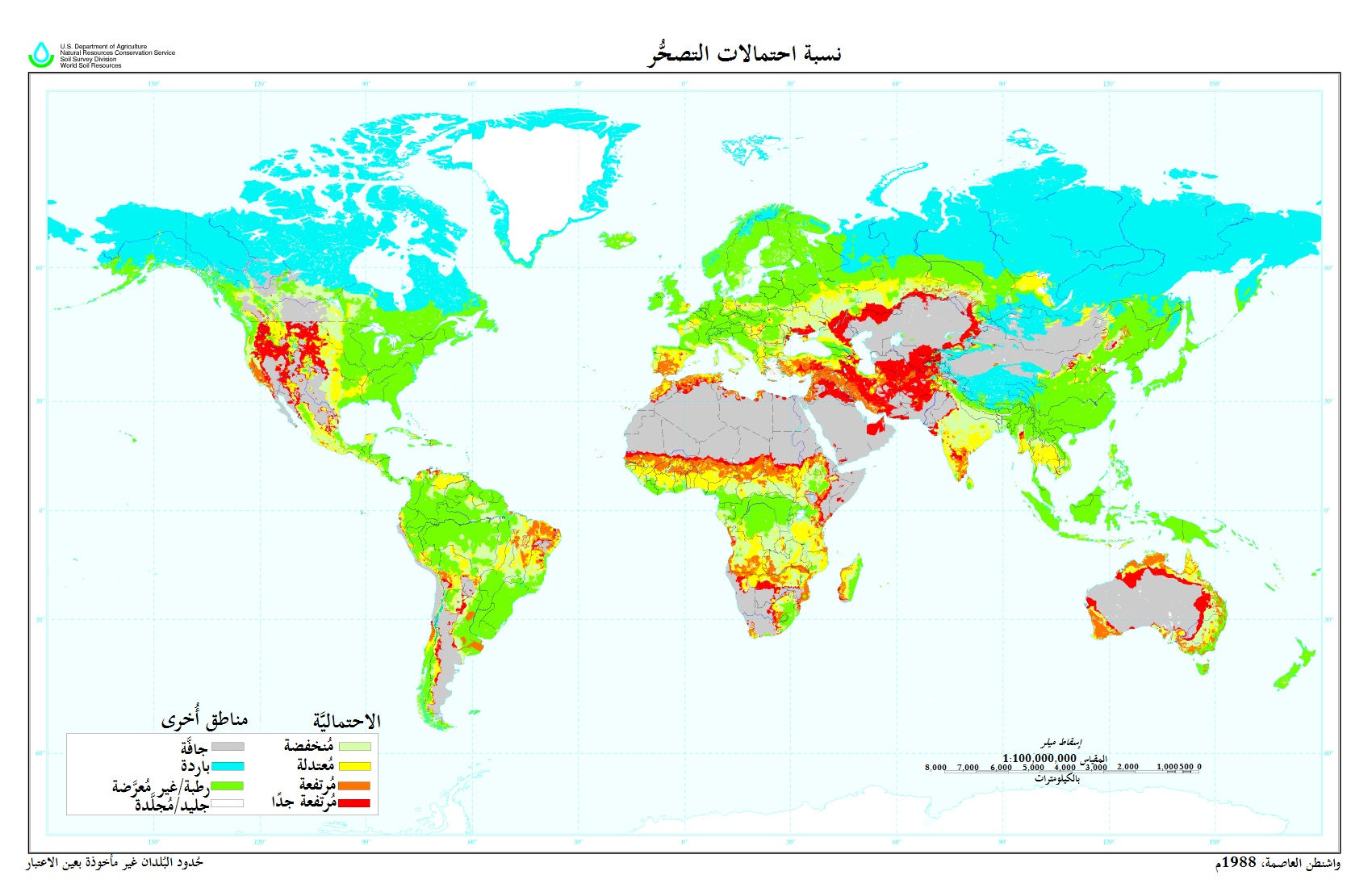
العربية: خارطة تُظهر نسبة مُعدَّلات التصحُّر في العالم
English: see the english version; the publication date is 1998 not 1988 as indicated in the map |
| Date | |
| Source | Derivative from this file |
| Author |
|
| Other versions | English |
| This is a retouched picture, which means that it has been digitally altered from its original version. Modifications: Translated to Arabic - عُرِّبت. The original can be viewed here: Desertification map.png:
|
Licensing[edit]
This image or file is a work of a United States Department of Agriculture employee, taken or made as part of that person's official duties. As a work of the U.S. federal government, the image is in the public domain.
|
 |
File history
Click on a date/time to view the file as it appeared at that time.
| Date/Time | Thumbnail | Dimensions | User | Comment | |
|---|---|---|---|---|---|
| current | 19:15, 21 November 2015 | | 1,700 × 1,100 (435 KB) | باسم (talk | contribs) | User created page with UploadWizard |
You cannot overwrite this file.
File usage on Commons
There are no pages that use this file.
File usage on other wikis
The following other wikis use this file:
- Usage on ar.wikipedia.org
- Usage on mn.wikipedia.org