File:Continentes.png
Jump to navigation
Jump to search
Size of this preview: 800 × 406 pixels. Other resolutions: 320 × 162 pixels | 640 × 325 pixels | 1,488 × 755 pixels.
Original file (1,488 × 755 pixels, file size: 24 KB, MIME type: image/png)
Captions
Captions
Add a one-line explanation of what this file represents
Summary[edit]
|
Phillipines
|
 |
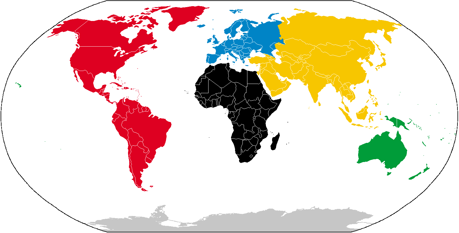
Deutsch: Karte der Kontinente, basierend auf File:BlankMap-World.png. Die Karte enthält keine Beschriftung, damit sie als Grundlage für verschiedene Sprachen benutzt werden kann.
English: Compiled chiefly from File:BlankMap-World.png. Blank to permit labels in various languages.
Español: Mapa mudo basado en File:BlankMap-World.png con la distribución continental tradicional.
Français : Carte des continents, depuis File:BlankMap-World.png. C'est vide pour permettre aux gens d'ajouter des étiquettes propres à diverses langues.
Italiano: Carta dei continenti, basata su File:BlankMap-World.png. La carta non contiene descrizioni, in modo che possa essere utilizzata in ogni lingua.
Русский: Взято за основу File:BlankMap-World.png. На изображении нет надписей для возможности использования одного изображения в разных виках.
Licensing[edit]
I, the copyright holder of this work, hereby publish it under the following license:
This file is licensed under Creative Commons ShareAlike 1.0 License.
Creative Commons has retired this legal tool and does not recommend that it be applied to works.
|
File history
Click on a date/time to view the file as it appeared at that time.
| Date/Time | Thumbnail | Dimensions | User | Comment | |
|---|---|---|---|---|---|
| current | 09:24, 6 February 2015 | | 1,488 × 755 (24 KB) | Giorgi Balakhadze (talk | contribs) | Fixing borders. |
| 02:20, 21 September 2014 |  | 1,488 × 755 (21 KB) | AnonMoos (talk | contribs) | increase PNG compression; transparent outside map frame | |
| 01:16, 20 September 2014 |  | 1,488 × 755 (44 KB) | Leftcry (talk | contribs) | Fixed Europe;added South Sudan border | |
| 19:43, 16 November 2011 |  | 1,488 × 755 (18 KB) | Spiritia (talk | contribs) | Reverted to version as of 11:41, 28 March 2009 | |
| 10:38, 6 November 2011 |  | 1,488 × 755 (24 KB) | Fadams (talk | contribs) | +Atlantis | |
| 11:41, 28 March 2009 |  | 1,488 × 755 (18 KB) | Insuranze (talk | contribs) | Compressed once more | |
| 14:07, 19 January 2009 |  | 1,488 × 755 (21 KB) | Nyat (talk | contribs) | compressed | |
| 00:21, 16 March 2007 |  | 1,488 × 755 (24 KB) | Serg!o (talk | contribs) | {| | Olympic flag.svg|thumb|Olimpic flag |{{legend|#202020|America}} {{legend|#f7c600|Asia}} {{legend|#ffff80|Africa}} {{legend|#0084c6|Europe}} {{legend|#009c39|Oceania}} {{legend|#ffffc0|Antarctica}} |} {{deutsch}} Ka |
You cannot overwrite this file.
File usage on Commons
The following 5 pages use this file:
File usage on other wikis
The following other wikis use this file:
- Usage on an.wikipedia.org
- Usage on ay.wikipedia.org
- Usage on bcl.wikipedia.org
- Usage on be-tarask.wikipedia.org
- Usage on be.wikipedia.org
- Usage on bi.wikipedia.org
- Usage on bjn.wikipedia.org
- Usage on bn.wikipedia.org
- Usage on bpy.wikipedia.org
- Usage on br.wikipedia.org
- Usage on ca.wikipedia.org
- Usage on cs.wikipedia.org
- Usage on cy.wikipedia.org
- Usage on de.wikipedia.org
- Geschichte Europas
- Geschichte Amerikas
- Geschichte Südamerikas
- Geschichte Nordamerikas
- Geschichte Mittelamerikas
- Geschichte Australiens
- Geschichte Asiens
- Geschichte Afrikas
- Antarktika
- Geschichte Ozeaniens
- Wikipedia:WikiProjekt Geographie/Kategoriekonzept/Anforderungen
- Benutzer:Raf-dat/Weltkartensammlung
- Zeittafel der Menschheitsgeschichte
- Menschheitsgeschichte
- Vorlage:Navigationsleiste Menschheitsgeschichte geographisch
- Benutzer:Casadopovo/VISUALISIERUNG THERMODYNAMISCHER SYSTEME
- Usage on dsb.wikipedia.org
- Usage on el.wiktionary.org
- Usage on es.wikipedia.org
- Usage on es.wikibooks.org
- Usage on eu.wikipedia.org
- Usage on fj.wikipedia.org
- Usage on haw.wikipedia.org
- Usage on hsb.wikipedia.org
- Usage on ia.wikipedia.org
- Usage on ie.wikipedia.org
- Usage on it.wikipedia.org
- Usage on jbo.wikipedia.org
View more global usage of this file.