File:Nifas Silk-Lafto (Addis Ababa Map).png
Jump to navigation
Jump to search
No higher resolution available.
Nifas_Silk-Lafto_(Addis_Ababa_Map).png (640 × 600 pixels, file size: 17 KB, MIME type: image/png)
Captions
Captions
Add a one-line explanation of what this file represents

|
This locator map image could be re-created using vector graphics as an SVG file. This has several advantages; see Commons:Media for cleanup for more information. If an SVG form of this image is available, please upload it and afterwards replace this template with
{{vector version available|new image name}}.
It is recommended to name the SVG file “Nifas Silk-Lafto (Addis Ababa Map).svg”—then the template Vector version available (or Vva) does not need the new image name parameter. |
Summary[edit]
.png&action=edit§ion=1)
| Description |
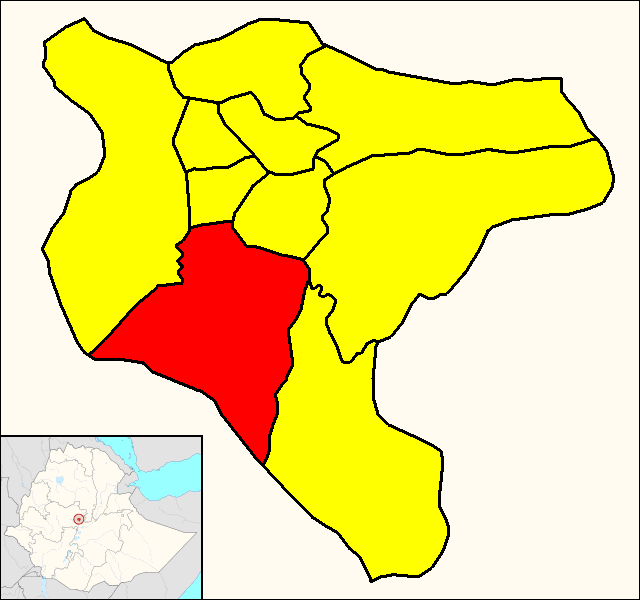
English: Map of the district (subcity) of Nifas Silk-Lafto (shown in red) within the city of Addis Ababa (yellow). |
| Date | |
| Source | Own work. The map was derived following Google Maps, the datas about the districts have been found on the Addis Ababa official website (see the section "Sub Cities"). The little Ethiopian map showing Addis Ababa position derives from the File:Addis Ababa in Ethiopia (special marker).svg by TUBS. |
| Author | Dэя-Бøяg |
.svg)
Licensing[edit]
.png&action=edit§ion=2)
I, the copyright holder of this work, hereby publish it under the following licenses:

|
Permission is granted to copy, distribute and/or modify this document under the terms of the GNU Free Documentation License, Version 1.2 or any later version published by the Free Software Foundation; with no Invariant Sections, no Front-Cover Texts, and no Back-Cover Texts. A copy of the license is included in the section entitled GNU Free Documentation License. |
| This file is licensed under the Creative Commons Attribution-Share Alike 3.0 Unported license. | ||
| ||
| This licensing tag was added to this file as part of the GFDL licensing update. |
You may select the license of your choice.
File history
Click on a date/time to view the file as it appeared at that time.
| Date/Time | Thumbnail | Dimensions | User | Comment | |
|---|---|---|---|---|---|
| current | 03:47, 17 January 2014 | | 640 × 600 (17 KB) | DerBorg (talk | contribs) | == {{int:filedesc}} == {{Information |Description={{en|1=Map of the district (subcity) of Nifas Silk-Lafto (shown in red) within the city of Addis Ababa (yellow).}} |Source= Own work. The map was derived following Google Maps, the datas about the distr... |
You cannot overwrite this file.
File usage on Commons
There are no pages that use this file.
File usage on other wikis
The following other wikis use this file:
- Usage on am.wikipedia.org
- Usage on bn.wikipedia.org
- Usage on de.wikipedia.org
- Usage on en.wikipedia.org
- Usage on fr.wikipedia.org
- Usage on it.wikipedia.org
- Usage on ka.wikipedia.org
- Usage on nl.wikipedia.org
- Usage on no.wikipedia.org
- Usage on ru.wikipedia.org
- Usage on vi.wikipedia.org
- Usage on www.wikidata.org
- Usage on zh.wikipedia.org
- Usage on zu.wikipedia.org
.png&oldid=485520199)