File:Komargorod pond 2013 G5.jpg
Jump to navigation
Jump to search
Size of this preview: 800 × 406 pixels. Other resolutions: 320 × 162 pixels | 640 × 325 pixels | 1,024 × 520 pixels | 1,280 × 649 pixels | 2,560 × 1,299 pixels | 5,184 × 2,630 pixels.
Original file (5,184 × 2,630 pixels, file size: 5 MB, MIME type: image/jpeg)
Captions
Captions
Add a one-line explanation of what this file represents
Summary[edit]
| Description |
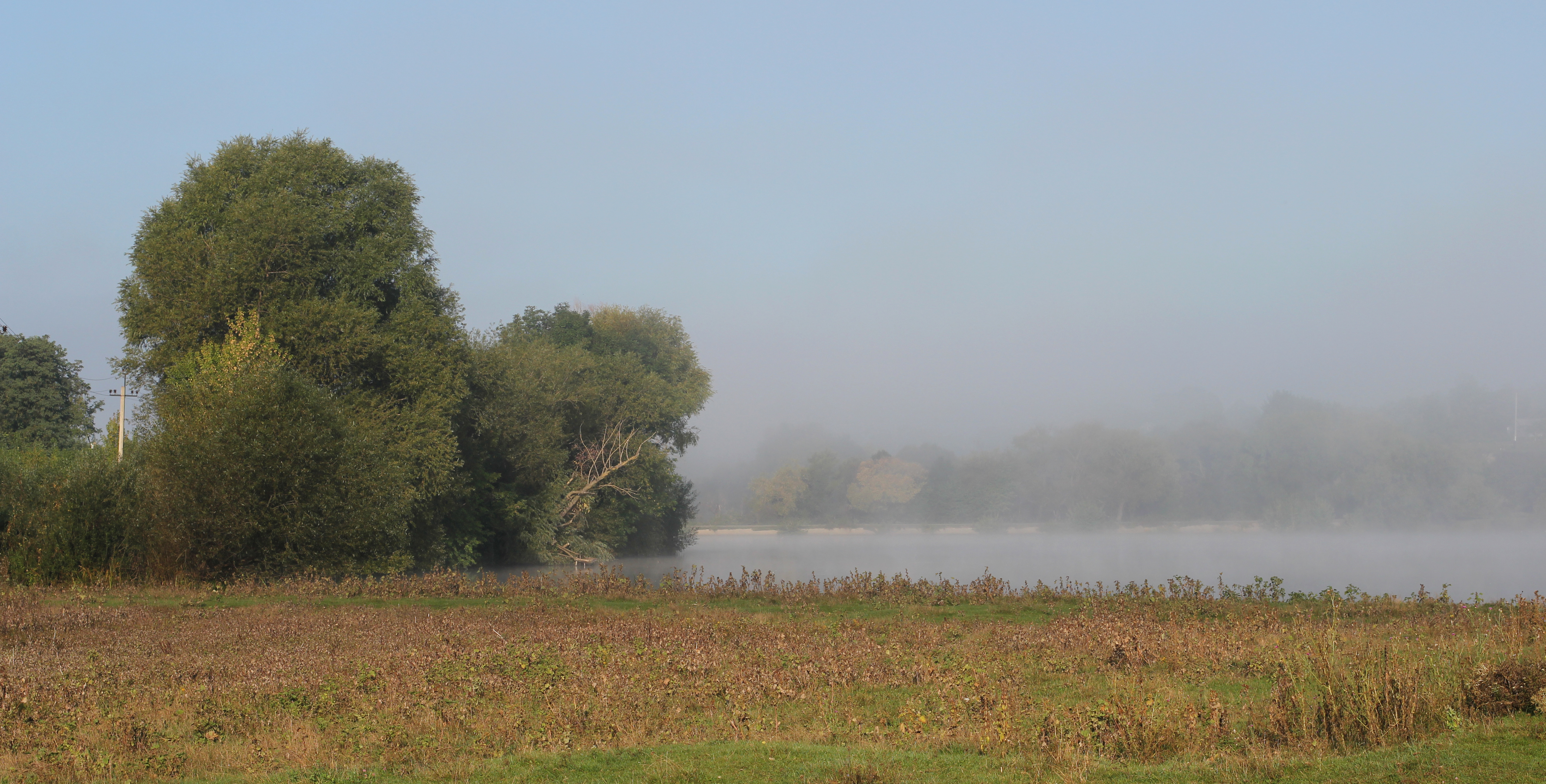
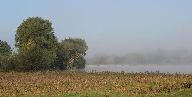
English: Dawn. A pond on the Tomashpilka river in the village of Komargorod. The first beams of the sun and fog over water. Tomashpil Raion of Vinnytsia Oblast. Ukraine.
Español: Los primeros rayos del sol y la niebla matutina sobre el agua de un estanque en el río Tomashpilka en el pueblo de Komargorod, Raión de Tomashpil, óblast de Vínnytsia, Ucrania.
Polski: Świt nad stawem na rzece Tomaszpilka we wsi Komargród w rejonie tomaszpolskim obwodu winnickiego na Ukrainie.
Русский: Рассвет. Пруд на реке Томашполька в селе Комаргород. Томашпольский район Винницкой области.
Українська: Світанок в Комаргороді. Ставок на річці Томашпілька в центрі села. Томашпільський район Вінницької області.
Македонски: Изгрев: Бара на реката Томашполка кај селото Комаргород, Виничка област, Украина.
Nederlands: Rivier en ochtendmist in Komargorod, een dorpje in de oblast Vinnytsja in het westen van Oekraïne
Português: Os primeiros raios de sol e a névoa matutina sobre a água do rio Tomashpilka na vila de Komargorod, região de Vinnitsa, Ucrânia. |
||
| Date | |||
| Source | Own work | ||
| Author | George Chernilevsky | ||
| Permission (Reusing this file) |
|
| Camera location | | View this and other nearby images on: OpenStreetMap |
|---|
Assessment[edit]
|
This image was selected as picture of the day on Wikimedia Commons for 20 September 2017. It was captioned as follows: English: Dawn. A pond on the Tomashpilka river in the village of Komargorod. The first beams of the sun and fog over water. Tomashpil Raion of Vinnytsia Oblast. Ukraine. Other languages:
English: Dawn. A pond on the Tomashpilka river in the village of Komargorod. The first beams of the sun and fog over water. Tomashpil Raion of Vinnytsia Oblast. Ukraine. Español: Los primeros rayos del sol y la niebla matutina sobre el agua de un estanque en el río Tomashpilka en el pueblo de Komargorod, Raión de Tomashpil, óblast de Vínnytsia, Ucrania. Nederlands: Rivier en ochtendmist in Komargorod, een dorpje in de oblast Vinnytsja in het westen van Oekraïne Polski: Świt nad stawem na rzece Tomaszpilka we wsi Komargród w rejonie tomaszpolskim obwodu winnickiego na Ukrainie. Português: Os primeiros raios de sol e a névoa matutina sobre a água do rio Tomashpilka na vila de Komargorod, região de Vinnitsa, Ucrânia. Македонски: Изгрев: Бара на реката Томашполка кај селото Комаргород, Виничка област, Украина. Русский: Рассвет. Пруд на реке Томашполька в селе Комаргород. Томашпольский район Винницкой области. Українська: Світанок в Комаргороді. Ставок на річці Томашпілька в центрі села. Томашпільський район Вінницької області. |
File history
Click on a date/time to view the file as it appeared at that time.
| Date/Time | Thumbnail | Dimensions | User | Comment | |
|---|---|---|---|---|---|
| current | 18:19, 20 January 2016 | | 5,184 × 2,630 (5 MB) | George Chernilevsky (talk | contribs) | Recreated from source and cropped |
| 04:52, 26 May 2015 |  | 5,184 × 3,000 (6.25 MB) | George Chernilevsky (talk | contribs) | User created page with UploadWizard |
You cannot overwrite this file.
File usage on Commons
The following 25 pages use this file:
- Featured Photographs in the Public Domain
- User talk:George Chernilevsky/Archive/Archive 2015 2
- User talk:George Chernilevsky/Archive/Archive 2016 2
- Commons:Featured picture candidates/File:Komargorod pond 2013 G5.jpg
- Commons:Featured pictures/Places/Natural
- Commons:Featured pictures/chronological/2016-A
- Commons:Picture of the Year/2016/Candidates
- Commons:Picture of the Year/2016/R1/Gallery/2016-A
- Commons:Picture of the Year/2016/R1/Gallery/ALL
- Commons:Picture of the Year/2016/R1/Gallery/M01
- Commons:Picture of the Year/2016/R1/Gallery/Nature views
- Commons:Picture of the Year/2016/R1/v/Komargorod pond 2013 G5.jpg
- Commons:Quality images/Subject/Natural phenomena
- Commons:Quality images candidates/Archives May 29 2015
- Template:Potd/2017-09
- Template:Potd/2017-09-20
- Template:Potd/2017-09-20 (en)
- Template:Potd/2017-09-20 (es)
- Template:Potd/2017-09-20 (hu)
- Template:Potd/2017-09-20 (mk)
- Template:Potd/2017-09-20 (nl)
- Template:Potd/2017-09-20 (pl)
- Template:Potd/2017-09-20 (pt)
- Template:Potd/2017-09-20 (ru)
- Template:Potd/2017-09-20 (uk)
File usage on other wikis
The following other wikis use this file:
- Usage on av.wikipedia.org
- Usage on be-tarask.wikipedia.org
- Usage on crh.wikipedia.org
- Usage on cv.wikipedia.org
- Usage on en.wikipedia.org
- Usage on hu.wikipedia.org
- Usage on hy.wikipedia.org
- Usage on ka.wikipedia.org
- Usage on ko.wikipedia.org
- Usage on krc.wikipedia.org
- Usage on lbe.wikipedia.org
- Usage on lez.wikipedia.org
- Usage on mdf.wikipedia.org
- Usage on mk.wikipedia.org
- Usage on os.wikipedia.org
- Usage on pt.wikipedia.org
- Usage on ru.wikipedia.org
- Usage on ru.wikinews.org
- Usage on sah.wikipedia.org
- Usage on te.wikipedia.org
- Usage on tt.wikipedia.org
- Usage on tyv.wikipedia.org
- Usage on udm.wikipedia.org
- Usage on uk.wikipedia.org
- Usage on vep.wikipedia.org
- Usage on xal.wikipedia.org
- Usage on zh.wikipedia.org