File:Outline Map of Kamchatka Krai.png
Jump to navigation
Jump to search

Size of this preview: 557 × 599 pixels. Other resolutions: 223 × 240 pixels | 446 × 480 pixels | 886 × 953 pixels.
Original file (886 × 953 pixels, file size: 119 KB, MIME type: image/png)
Captions
Captions
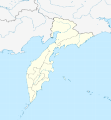
Administrative map of the Kamchatka peninsula (Russia).
Summary[edit]
| Description |
Русский: Административная карта Камчатского края (Россия).
|
| Date | |
| Source |
|
| Author | Nzeemin |
| Other versions |
|

Licensing[edit]
I, the copyright holder of this work, hereby publish it under the following license:
This file is licensed under the Creative Commons Attribution-Share Alike 3.0 Unported license.
- You are free:
- to share – to copy, distribute and transmit the work
- to remix – to adapt the work
- Under the following conditions:
- attribution – You must give appropriate credit, provide a link to the license, and indicate if changes were made. You may do so in any reasonable manner, but not in any way that suggests the licensor endorses you or your use.
- share alike – If you remix, transform, or build upon the material, you must distribute your contributions under the same or compatible license as the original.
File history
Click on a date/time to view the file as it appeared at that time.
| Date/Time | Thumbnail | Dimensions | User | Comment | |
|---|---|---|---|---|---|
| current | 16:42, 6 December 2014 | | 886 × 953 (119 KB) | Leftcry (talk | contribs) | making the kuril islands grey |
| 13:36, 19 February 2012 |  | 886 × 953 (129 KB) | Nzeemin (talk | contribs) | plus region bounds | |
| 07:02, 18 February 2012 |  | 886 × 953 (112 KB) | Nzeemin (talk | contribs) |
You cannot overwrite this file.
File usage on Commons
The following 2 pages use this file:
File usage on other wikis
The following other wikis use this file:
- Usage on af.wikipedia.org
- Usage on als.wikipedia.org
- Usage on ar.wikipedia.org
- Usage on azb.wikipedia.org
- Usage on az.wikipedia.org
- Usage on be.wikipedia.org
- Usage on bg.wikipedia.org
- Usage on ceb.wikipedia.org
- Usage on ce.wikipedia.org
- Петропавловск-Камчатски
- Никольски (Камчаткин мохк)
- Кеп:Меттиган карта Росси Камчаткин мохк
- Эссо
- Анавгай
- Горни Ключ (Камчаткин мохк)
- Елизово (гӀала)
- Вулканни
- Коряки (эвла)
- Сокоч
- Николаевка (Камчаткин мохк)
- Нови (Камчаткин мохк)
- Лесной (Камчаткин мохк)
- Паратунка (эвла)
- Пионерски (Камчаткин мохк)
- Раздольни (Камчаткин мохк)
- Березняки (Камчаткин мохк)
- Ганалы
- Дальни (Камчаткин мохк)
- Двуречье (Камчаткин мохк)
- Зелёни (Камчаткин мохк)
- Кеткино
View more global usage of this file.