File:Map of Malta 2.png
Jump to navigation
Jump to search
Size of this preview: 531 × 599 pixels. Other resolutions: 213 × 240 pixels | 425 × 480 pixels | 987 × 1,114 pixels.
Original file (987 × 1,114 pixels, file size: 1.34 MB, MIME type: image/png)
Captions
Captions
Add a one-line explanation of what this file represents

|
This map has been uploaded by Electionworld from en.wikipedia.org to enable the |
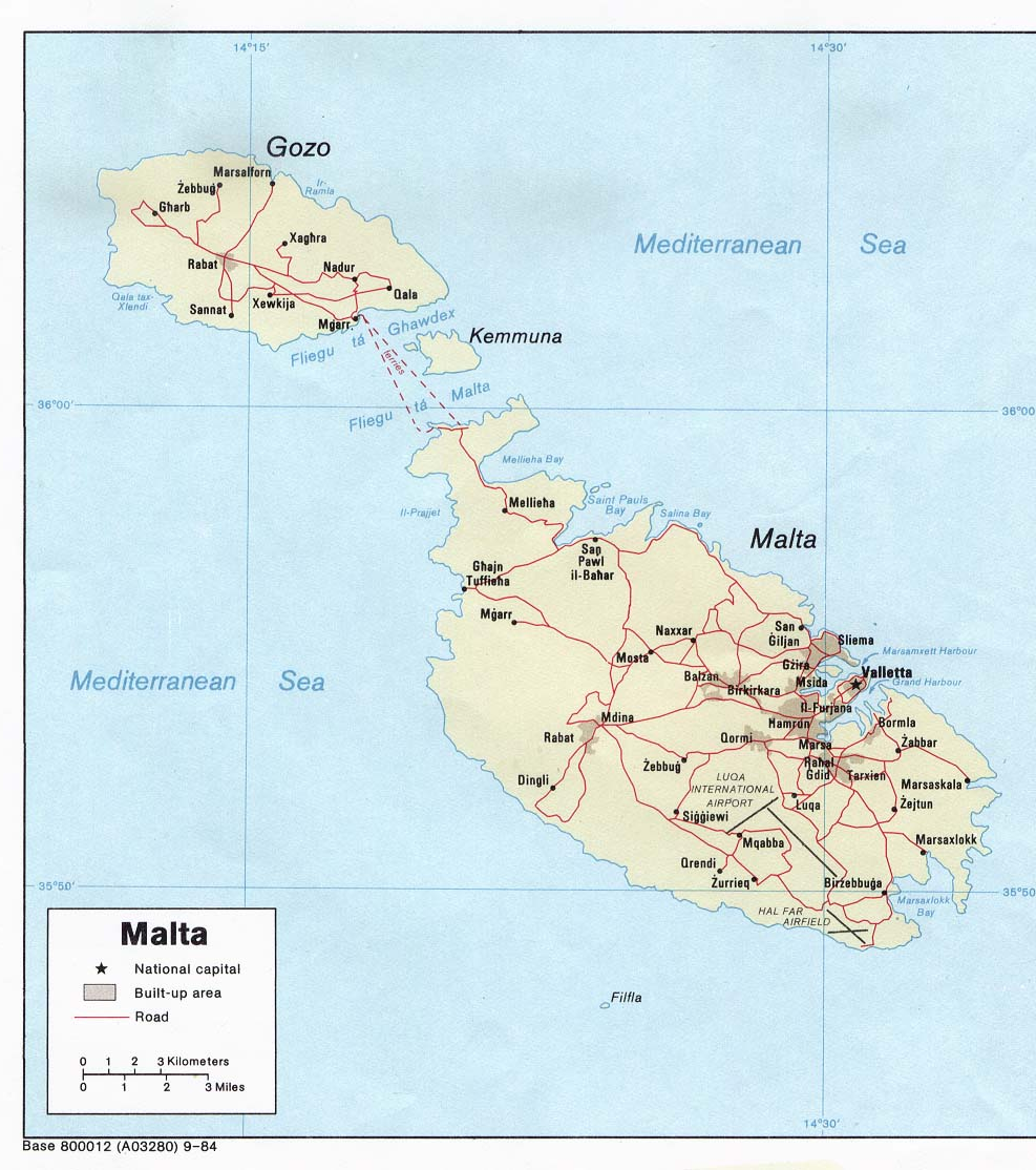
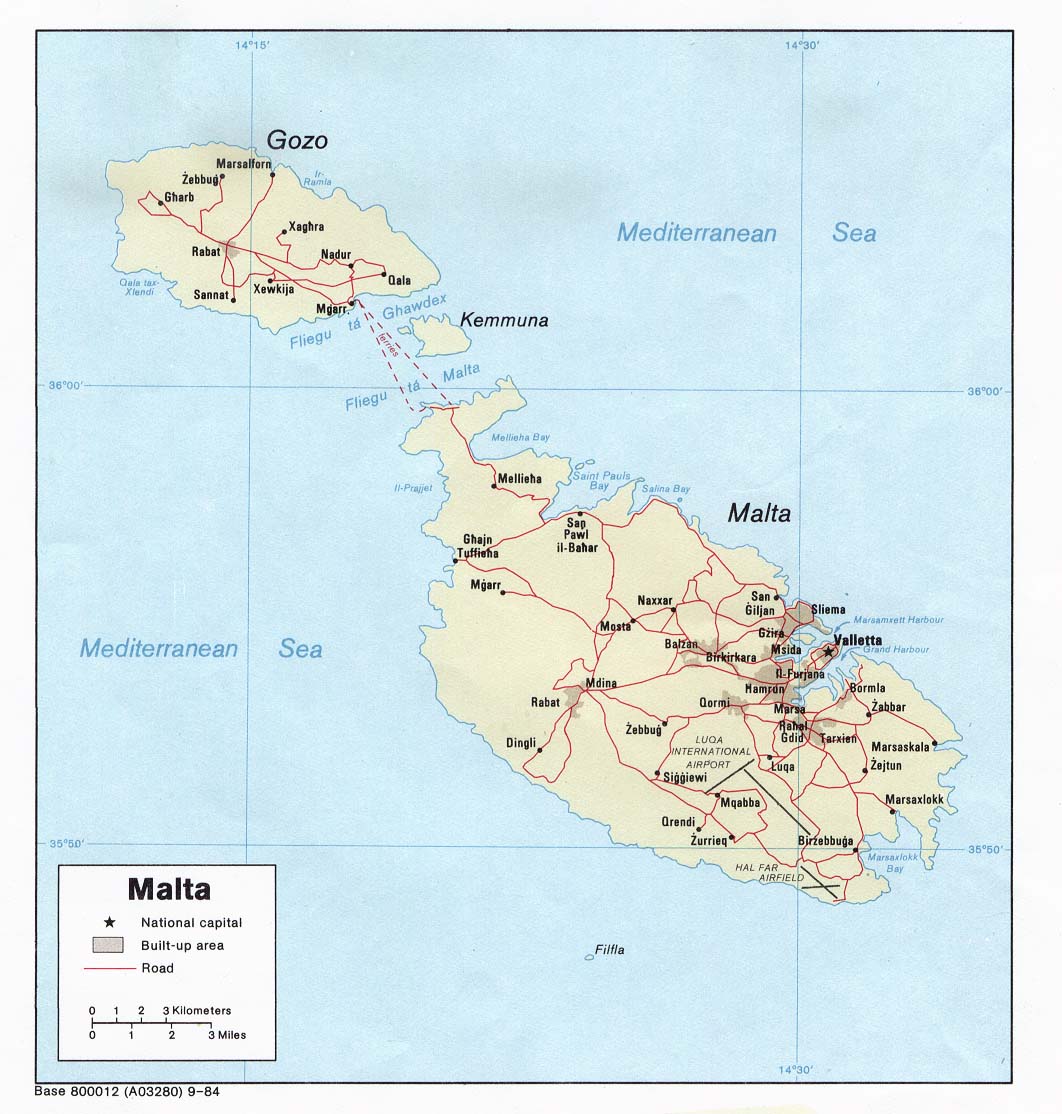
Political map of Malta. Created in 1984 by the Central Intelligence Agency.
This image is in the public domain because it contains materials that originally came from the United States Central Intelligence Agency's World Factbook.
|
 |
http://www.lib.utexas.edu/maps/europe.html
http://www.lib.utexas.edu/maps/europe/malta_pol84.jpg
File history
Click on a date/time to view the file as it appeared at that time.
| Date/Time | Thumbnail | Dimensions | User | Comment | |
|---|---|---|---|---|---|
| current | 18:40, 27 December 2006 | | 987 × 1,114 (1.34 MB) | Electionworld (talk | contribs) | {{ew|en|Neutrality}} Political map of Malta. Created in 1984 by the Central Intelligence Agency. {{PD-USGov-CIA-WF}} http://www.lib.utexas.edu/maps/europe.html http://www.lib.utexas.edu/maps/europe/malta_pol84.jpg |
You cannot overwrite this file.
File usage on Commons
The following page uses this file:
File usage on other wikis
The following other wikis use this file:
- Usage on af.wikipedia.org
- Usage on bs.wikipedia.org
- Usage on ca.wikipedia.org
- Usage on de.wikipedia.org
- Usage on el.wikipedia.org
- Usage on en.wikipedia.org
- Usage on fa.wikipedia.org
- Usage on fr.wikipedia.org
- Usage on hr.wikipedia.org
- Usage on hr.wiktionary.org
- Usage on hu.wikipedia.org
- Usage on io.wikipedia.org
- Usage on ja.wikipedia.org
- Usage on mk.wikipedia.org
- Usage on nn.wikipedia.org
- Usage on pl.wiktionary.org
- Usage on ps.wikipedia.org
- Usage on ro.wikipedia.org
- Usage on sco.wikipedia.org
- Usage on sh.wikipedia.org
- Usage on sl.wikipedia.org
- Usage on sr.wikipedia.org
- Usage on sv.wikivoyage.org
- Usage on te.wikipedia.org
- Usage on trv.wikipedia.org
- Usage on tr.wikipedia.org
- Usage on uk.wikipedia.org
- Usage on zh.wikipedia.org