File:Canada Exclusive Economic Zone.PNG
Jump to navigation
Jump to search

Size of this preview: 800 × 391 pixels. Other resolutions: 320 × 156 pixels | 640 × 313 pixels | 1,024 × 501 pixels | 1,280 × 626 pixels | 2,410 × 1,178 pixels.
Original file (2,410 × 1,178 pixels, file size: 155 KB, MIME type: image/png)
Captions
Captions
Add a one-line explanation of what this file represents

|
This economic map image could be re-created using vector graphics as an SVG file. This has several advantages; see Commons:Media for cleanup for more information. If an SVG form of this image is available, please upload it and afterwards replace this template with
{{vector version available|new image name}}.
It is recommended to name the SVG file “Canada Exclusive Economic Zone.svg”—then the template Vector version available (or Vva) does not need the new image name parameter. |
Summary[edit]
| Description |
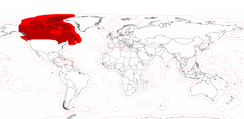
English: Canada's Exclusive Economic Zones. |
| Date | |
| Source | Own work |
| Author | Pyrophobe |
Licensing[edit]
| I, the copyright holder of this work, release this work into the public domain. This applies worldwide. In some countries this may not be legally possible; if so: I grant anyone the right to use this work for any purpose, without any conditions, unless such conditions are required by law. |
File history
Click on a date/time to view the file as it appeared at that time.
| Date/Time | Thumbnail | Dimensions | User | Comment | |
|---|---|---|---|---|---|
| current | 14:56, 25 July 2020 | | 2,410 × 1,178 (155 KB) | Maphobbyist (talk | contribs) | Added the borders of South Sudan and Montengro, and the Sea of Okhotsk is now wholly within the Russian EEZ. |
| 20:15, 4 May 2009 |  | 2,410 × 1,178 (182 KB) | Pyrophobe (talk | contribs) | {{Information |Description={{en|1=Canadas's Exclusive Economic Zones. }} |Source=Own work by uploader |Author=Pyrophobe |Date=2009/05/04 |Permission= |other_versions= }} <!--{{ImageUpload|full}}--> |
You cannot overwrite this file.
File usage on Commons
There are no pages that use this file.
File usage on other wikis
The following other wikis use this file:
- Usage on af.wikipedia.org
- Usage on en.wikipedia.org
- Usage on fr.wikipedia.org
- Usage on he.wikipedia.org
- Usage on kn.wikipedia.org
- Usage on pt.wikipedia.org
- Usage on sk.wikipedia.org
- Usage on th.wikipedia.org