File:Baikal.A2001296.0420.250m-NASA.jpg
Jump to navigation
Jump to search
Size of this preview: 463 × 599 pixels. Other resolutions: 185 × 240 pixels | 371 × 480 pixels | 593 × 768 pixels | 791 × 1,024 pixels | 1,582 × 2,048 pixels | 3,400 × 4,400 pixels.
Original file (3,400 × 4,400 pixels, file size: 2.95 MB, MIME type: image/jpeg)
Captions
Captions
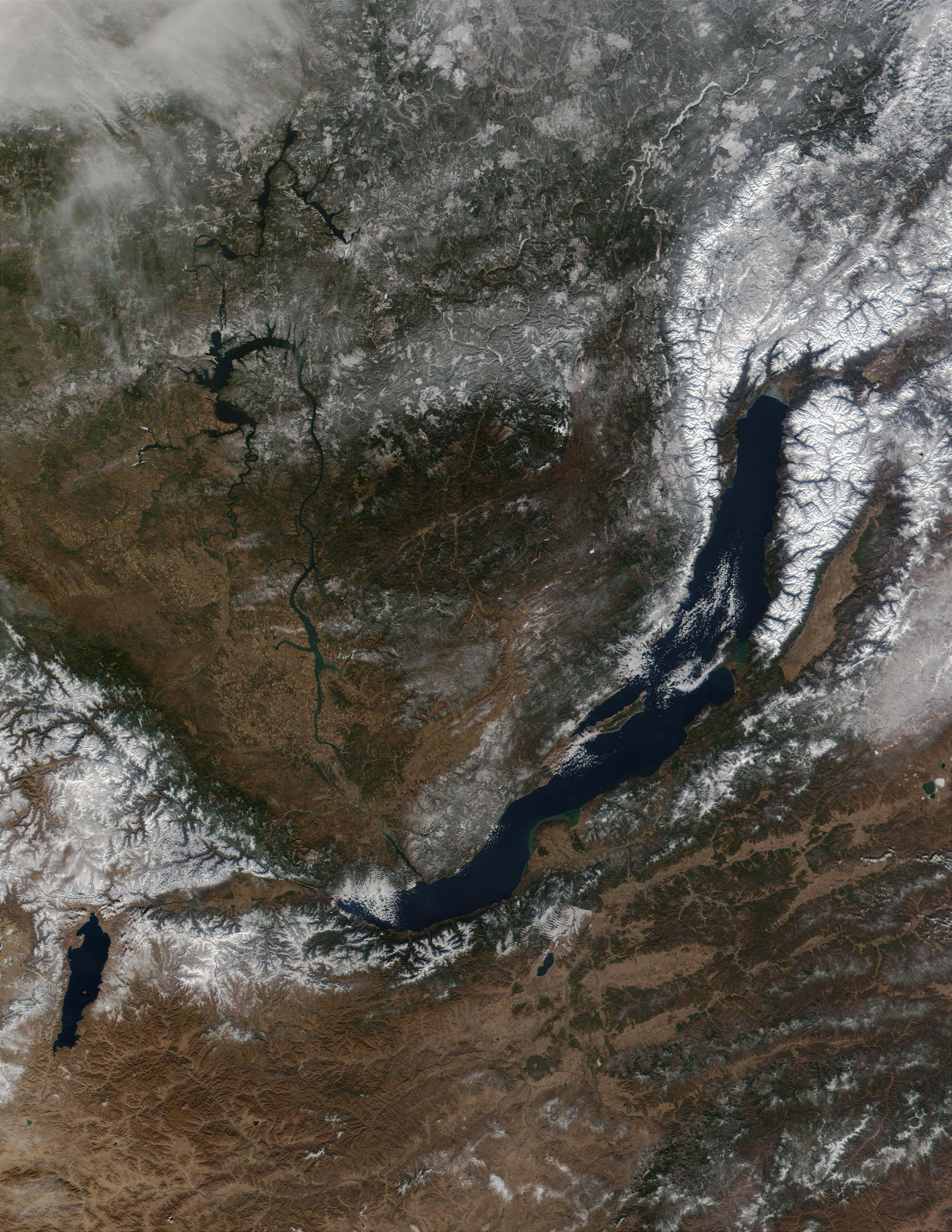
Satellite view of Lake Baikal
| Description |
Čeština: Bajkalské jezero ze satelitu
Magyar: Műholdfelvétel a Bajkál-tóról
|
|||||
| Date | Datastart 2001-10-23 - Visualization Date 2001-10-23 | |||||
| Source | http://visibleearth.nasa.gov/view_rec.php?id=2239 - http://visibleearth.nasa.gov/images/2239/Baikal.A2001296.0420.500m.jpg - Visible Earth v1 ID 10671 | |||||
| Author | Jacques Descloitres, MODIS Land Rapid Response Team, NASA/GSFC | |||||
| Permission (Reusing this file) |
|

File history
Click on a date/time to view the file as it appeared at that time.
| Date/Time | Thumbnail | Dimensions | User | Comment | |
|---|---|---|---|---|---|
| current | 23:41, 20 July 2005 | | 3,400 × 4,400 (2.95 MB) | Bdk (talk | contribs) | *Lake Baikal from sa *Source: http://visibleearth.nasa.gov/view_rec.php?id=2239 - http://visibleearth.nasa.gov/images/2239/Baikal.A2001296.0420.500m.jpg - Visible Earth v1 ID 10671 *Sensor: Terra/MODIS *Date: Datastart 2001-10-23 - Visualization Date 2001 |
You cannot overwrite this file.
File usage on Commons
The following 2 pages use this file:
File usage on other wikis
The following other wikis use this file:
- Usage on af.wikipedia.org
- Usage on ary.wikipedia.org
- Usage on az.wikipedia.org
- Usage on ba.wikipedia.org
- Usage on bg.wikipedia.org
- Usage on bn.wikipedia.org
- Usage on bxr.wikipedia.org
- Usage on ce.wikipedia.org
- Usage on cv.wikipedia.org
- Usage on cy.wikipedia.org
- Usage on el.wiktionary.org
- Usage on en.wikipedia.org
- Usage on fo.wikipedia.org
- Usage on fy.wikipedia.org
- Usage on hy.wikipedia.org
- Usage on id.wikipedia.org
- Usage on incubator.wikimedia.org
- Usage on ka.wikipedia.org
- Usage on ko.wikipedia.org
- Usage on li.wikipedia.org
- Usage on lt.wikipedia.org
- Usage on lv.wikipedia.org
- Usage on mn.wikipedia.org
- Usage on myv.wikipedia.org
- Usage on nl.wikipedia.org
- Usage on ro.wikipedia.org
- Usage on ru.wikipedia.org
- Usage on sc.wikipedia.org
- Usage on sl.wikipedia.org
- Usage on th.wikipedia.org
- Usage on uk.wikipedia.org
- Usage on vep.wikipedia.org
- Usage on vi.wikipedia.org