File:BahamasOMC.png
Jump to navigation
Jump to search
Size of this preview: 597 × 600 pixels. Other resolutions: 239 × 240 pixels | 478 × 480 pixels | 927 × 931 pixels.
Original file (927 × 931 pixels, file size: 61 KB, MIME type: image/png)
Captions
Captions
Add a one-line explanation of what this file represents
Summary[edit]
| Description |
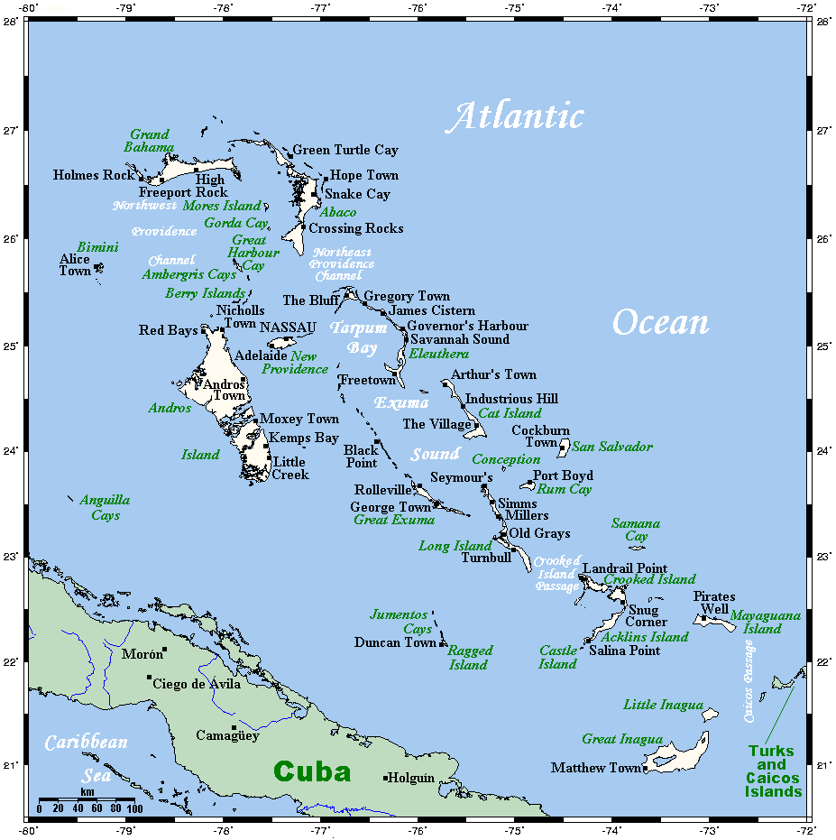
English: A map showing the Bahamas' cities and main towns. This map's source is here, with the uploader's modifications, and the GMT homepage says that the tools are released under the GNU General Public License. |
| Date | 29 July 2007 (original upload date) |
| Source | Transferred from en.wikipedia |
| Author | Original uploader was Kelisi at en.wikipedia |
| Permission (Reusing this file) |
CC-BY-SA-3.0-MIGRATED; Released under the GNU Free Documentation License. |
Licensing[edit]
| This file is licensed under the Creative Commons Attribution-Share Alike 3.0 Unported license. | ||
| ||
| This licensing tag was added to this file as part of the GFDL licensing update. |
Kelisi at the English-language Wikipedia, the copyright holder of this work, hereby publishes it under the following license:
| This file is licensed under the Creative Commons Attribution-Share Alike 3.0 Unported license. Subject to disclaimers. | ||
| Attribution: Kelisi at the English-language Wikipedia | ||
| ||
| This licensing tag was added to this file as part of the GFDL licensing update. |

|
Permission is granted to copy, distribute and/or modify this document under the terms of the GNU Free Documentation License, Version 1.2 or any later version published by the Free Software Foundation; with no Invariant Sections, no Front-Cover Texts, and no Back-Cover Texts. A copy of the license is included in the section entitled GNU Free Documentation License. Subject to disclaimers. |
Original upload log[edit]
The original description page was here. All following user names refer to en.wikipedia.
- 2009-11-03 04:19 Kelisi 927×931× (62625 bytes) Same author, same licence, a couple of modifications (Andros Town is bigger than Hard Bargain, and the Anguilla Cays deserve a mention).
- 2007-07-29 03:41 Kelisi 928×931× (43996 bytes) == Summary == A map showing the Bahamas' cities and main towns. This map's source is [http://www.aquarius.ifm-geomar.de/ here], with the uploader's modifications, and the [http://gmt.soest.hawaii.edu/ GMT homepage] says that the tools are released under t
File history
Click on a date/time to view the file as it appeared at that time.
| Date/Time | Thumbnail | Dimensions | User | Comment | |
|---|---|---|---|---|---|
| current | 17:23, 12 December 2010 | | 927 × 931 (61 KB) | Urdangaray (talk | contribs) | {{Information |Description={{en|<nowiki><math>Insert non-formatted text here</math>en:Media:Example.ogg</nowiki>== Summary == A map showing the Bahamas' cities and main towns. This map's source is [http://www.aquarius.ifm-geomar.de/ here], with the |
You cannot overwrite this file.
File usage on Commons
The following page uses this file:
File usage on other wikis
The following other wikis use this file:
- Usage on af.wikipedia.org
- Usage on az.wiktionary.org
- Usage on en.wikipedia.org
- Usage on eo.wikipedia.org
- Usage on es.wikipedia.org
- Usage on eu.wikipedia.org
- Usage on ka.wikipedia.org
- Usage on mad.wikipedia.org
- Usage on mk.wikipedia.org
- Usage on zh.wikipedia.org