File:Andorra topographic map-en.svg
Jump to navigation
Jump to search

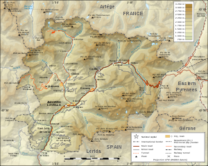
Size of this PNG preview of this SVG file: 750 × 600 pixels. Other resolutions: 300 × 240 pixels | 600 × 480 pixels | 960 × 768 pixels | 1,280 × 1,024 pixels | 2,560 × 2,048 pixels | 1,625 × 1,300 pixels.
Original file (SVG file, nominally 1,625 × 1,300 pixels, file size: 1.56 MB)
Captions
Captions
Add a one-line explanation of what this file represents
Summary[edit]
| Description |
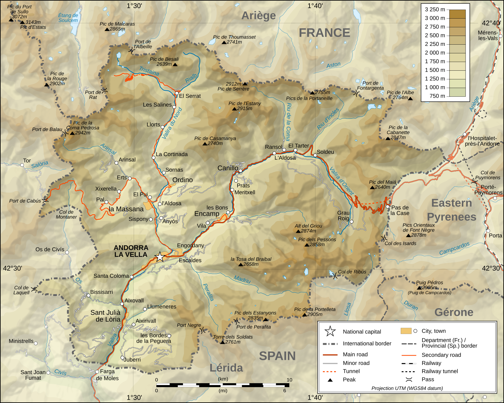
Deutsch: Topographische Karte von Andorra, englische Version English: Topographic map of Andorra Français : Carte topographique en anglais de l'Andorre |
| Date | February 2008 (translation March 2009) |
| Source |
English: Own work ; Topographic data from the NASA Shuttle Radar Topography Mission (SRTM3 v.2) (public domain) edited with 3DEM and dlgv32 Pro and vectorized with Inkscape ; UTM projection ; WGS84 datum ; shaded relief (composite image of N-W, W and N lightning positions) ; Reference used for the additional data : * Topographic maps available on the site of the Ministeri d'Urbanisme i Ordenament Territorial of Andorra ; * Géoportail France ; Approximate scale of topographic data : 1:400,000 (accuracy : about 100 m) ; Note : The shaded relief is a raster image embedded in the SVG file. Français : Création personnelle ; Données topographiques de la NASA Shuttle Radar Topography Mission (SRTM3 v.2) (domaine public) éditées avec 3DEM et dlgv32 Pro et vectorisées avec Inkscape ; projection UTM ; WGS84 datum ; relief ombré (image composite d'éclairages du N-O, O et N) ; Références utilisées pour les données complémentaires : * Cartes topographiques disponibles sur le site du Ministeri d'Urbanisme i Ordenament Territorial d'Andorre ; * Géoportail France ; Échelle approximative des données topographiques : 1:400 000 (précision : environ 100 m) ; Note : Le relief ombré est une image bitmap embarquée dans le fichier SVG. Approximate geographic limits of the map (3" close) : * SW corner : 42°24'30"N – 01°22'40"E * SE corner : 42°24'30"N – 01°50'20"E * NE corner : 42°40'55"N – 01°50'25"E * NW corner : 42°40'55"N – 01°22'35"E |
| Author | Eric Gaba (Sting - fr:Sting), English translation: User:Goldsztajn |
| Permission (Reusing this file) |
GFDL / Attribution and Share-Alike required |
| Other versions |
[]
|


|
This SVG file contains embedded text that can be translated into your language, using any capable SVG editor, text editor or the SVG Translate tool. For more information see: About translating SVG files. |
Licensing[edit]
I, the copyright holder of this work, hereby publish it under the following licenses:

|
Permission is granted to copy, distribute and/or modify this document under the terms of the GNU Free Documentation License, Version 1.2 or any later version published by the Free Software Foundation; with no Invariant Sections, no Front-Cover Texts, and no Back-Cover Texts. A copy of the license is included in the section entitled GNU Free Documentation License. |
This file is licensed under the Creative Commons Attribution-Share Alike 3.0 Unported license.
- You are free:
- to share – to copy, distribute and transmit the work
- to remix – to adapt the work
- Under the following conditions:
- attribution – You must give appropriate credit, provide a link to the license, and indicate if changes were made. You may do so in any reasonable manner, but not in any way that suggests the licensor endorses you or your use.
- share alike – If you remix, transform, or build upon the material, you must distribute your contributions under the same or compatible license as the original.
You may select the license of your choice.
File history
Click on a date/time to view the file as it appeared at that time.
| Date/Time | Thumbnail | Dimensions | User | Comment | |
|---|---|---|---|---|---|
| current | 01:34, 30 March 2009 | | 1,625 × 1,300 (1.56 MB) | Goldsztajn (talk | contribs) | {{Information |Description={{en|1=Map of Andorra}} |Source=http://commons.wikimedia.org/wiki/File:Andorra_topographic_map-fr.svg |Author=User:Sting fr:Utilisateur:Sting, english translation |Date=2009-03-30 |Permission= |other_versions= }} <!--{{ |
You cannot overwrite this file.
File usage on Commons
The following 14 pages use this file:
- Andorra
- File:Andorra topographic map-ca.svg
- File:Andorra topographic map-de.svg
- File:Andorra topographic map-en.svg
- File:Andorra topographic map-fr.svg
- File:Andorra topographic map-hu.svg
- File:Andorra topographic map-it.svg
- File:Andorra topographic map-mk.svg
- File:Andorra topographic map-pl.svg
- File:Andorra topographic map-ptbr.svg
- File:Andorra topographic map-sr.svg
- Template:Other versions/Andorra topographic map
- Category:Andorra
- Category:Geography of Andorra
File usage on other wikis
The following other wikis use this file:
- Usage on af.wikipedia.org
- Usage on ar.wikipedia.org
- Usage on azb.wikipedia.org
- Usage on bn.wikipedia.org
- Usage on el.wikipedia.org
- Usage on en.wikipedia.org
- Usage on fa.wikipedia.org
- Usage on fi.wikipedia.org
- Usage on ga.wikipedia.org
- Usage on gl.wikipedia.org
- Usage on hr.wiktionary.org
- Usage on id.wikipedia.org
- Usage on is.wikipedia.org
- Usage on ka.wikipedia.org
- Usage on lt.wikipedia.org
- Usage on ms.wikipedia.org
- Usage on pnb.wikipedia.org
- Usage on ro.wikipedia.org
- Usage on ru.wikipedia.org
- Usage on sv.wikipedia.org
- Usage on te.wikipedia.org
- Usage on trv.wikipedia.org
- Usage on uk.wikipedia.org
- Usage on vep.wikipedia.org
- Usage on vi.wikipedia.org
- Usage on www.wikidata.org
- Usage on zh-min-nan.wikipedia.org
- Usage on zh.wikipedia.org