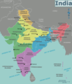
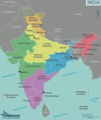
File:Map of India.png

Size of this preview: 513 × 599 pixels. Other resolutions: 206 × 240 pixels | 411 × 480 pixels | 658 × 768 pixels | 877 × 1,024 pixels | 1,754 × 2,048 pixels | 3,000 × 3,502 pixels.
Original file (3,000 × 3,502 pixels, file size: 1.16 MB, MIME type: image/png)
File history
Click on a date/time to view the file as it appeared at that time.
| Date/Time | Thumbnail | Dimensions | User | Comment | |
|---|---|---|---|---|---|
| current | 13:06, 3 June 2014 |  | 3,000 × 3,502 (1.16 MB) | Saqib | added Telangana state |
| 10:15, 15 December 2013 |  | 3,000 × 3,502 (1.15 MB) | Saqib | typo | |
| 22:11, 8 June 2013 |  | 1,251 × 1,461 (420 KB) | Saqib | removed hatching | |
| 18:04, 15 December 2012 |  | 1,001 × 1,169 (354 KB) | OgreBot | (BOT): Reverting to most recent version before archival | |
| 18:04, 15 December 2012 |  | 1,001 × 1,169 (332 KB) | OgreBot | (BOT): Uploading old version of file from wts.wikivoyage; originally uploaded on 2009-08-25 18:59:17 by (WT-shared) Cacahuate | |
| 18:04, 15 December 2012 |  | 1,033 × 1,186 (344 KB) | OgreBot | (BOT): Uploading old version of file from wts.wikivoyage; originally uploaded on 2009-08-25 05:47:26 by (WT-shared) Ravikiranr | |
| 18:04, 15 December 2012 |  | 996 × 1,186 (315 KB) | OgreBot | (BOT): Uploading old version of file from wts.wikivoyage; originally uploaded on 2008-07-06 09:09:11 by (WT-shared) Cacahuate | |
| 01:00, 18 November 2012 |  | 1,001 × 1,169 (354 KB) | MGA73bot2 | {{BotMoveToCommons|wts.oldwikivoyage|year={{subst:CURRENTYEAR}}|month={{subst:CURRENTMONTHNAME}}|day={{subst:CURRENTDAY}}}} == {{int:filedesc}} == {{Information |description=Map of India. A map of India's regions, states and metropolis', India * Map of... |
File usage
The following 3 pages use this file:
Global file usage
The following other wikis use this file:
- Usage on ast.wikipedia.org
- Usage on el.wikivoyage.org
- Usage on en.wiktionary.org
- Usage on fa.wikivoyage.org
- Usage on he.wikivoyage.org
- Usage on incubator.wikimedia.org
- Usage on it.wikivoyage.org
- Usage on ja.wikivoyage.org
- Usage on pt.wikivoyage.org
- Usage on ta.wiktionary.org
- Usage on vi.wikivoyage.org
Metadata
🔥 Popular: Main PageSpecial:SearchAshburn (Virginia)Wiki Travel:Destination of the month candidates/Slush pileList of country calling codesWiki Travel:AboutWiki Travel:HelpWiki Travel:Destination of the month candidates/Banners/Archive/2016Pan-American HighwaySnorkelingWiki Travel:Travellers' pubTalk:ChristianitySpecial:RecentChangesMoroccoUnited States of AmericaItalyThailandChinaLagunaEuropeWiki Travel:Destination of the Month candidates/Slush pileNorth AmericaFar North QueenslandEastern IndiaIndiaWiki Travel:Requested articlesAsiaQuezon City/CubaoCanadaAustraliaTokyoPhilippinesQuezon (province)CaviteTalk:BuffaloMuvattupuzhaGuangdongSingaporeSpainNorwayDestinationsJapanKasselPortugalAluvaJohor BahruSouth AmericaMauritiusMontenegroBerlinIsraelDanubeParisJeddahCentral AmericaViennaMidwestKothamangalamNew York CityKerguelenHong KongTenaliChukotkaWashington, D.C.Western IndiaFranceSouthern CaliforniaGrand Trunk RoadTaal VolcanoUser talk:HobbitschusterUSAAfricaPanayTurkish Republic of Northern CyprusGudalurLeipzigUnited KingdomPragueBalochi phrasebook